Zion National Park is a U.S. National Park located in southwestern Utah near the town Springdale. Zion Canyon, which is 15 miles long and up to 2,640 ft deep. The canyon walls are reddish and tan-colored Navajo Sandstone eroded by the North Fork of the Virgin River. The lowest point in the park is 3,666 ft at Coalpits Wash and the highest peak is 8,726 ft at Horse Ranch Mountain. Located at the junction of the Colorado Plateau, Great Basin, and Mojave Desert and regions, the park has a unique geography and a variety of life zones that allow for unusual plant and animal diversity. Numerous plant species as well as 289 species of birds, 75 mammals (including 19 species of bat), and 32 reptiles inhabit the park’s four life zones: desert, riparian, woodland, and coniferous forest. Zion National Park includes mountains, canyons, buttes, monoliths, rivers, slot canyons, and natural arches.
Kolob Canyons is the northwest section of Zion and are part of the Colorado Plateau region of the park and are noted for their colorful beauty and diverse landscape. This part of Zion National Park is accessed by a park road about 20 miles south of Cedar City, Utah off Interstate 15. In 1847, Mormon farmers from the Salt Lake area became the first people of European descent to settle the Virgin River region. In 1851, the Parowan and Cedar City areas were settled by Mormons who used the Kolob Canyons area for timber, and for grazing cattle, sheep, and horses. They prospected for mineral deposits, and diverted Kolob water to irrigate crops in the valley below. Mormon settlers named the area Kolob—in Mormon scripture, the nearest star to the planet where God resides.
Established: November 19, 1919
Size: 147,237 acres
Rank: 36
#Visitors in 2018: 4,320,033
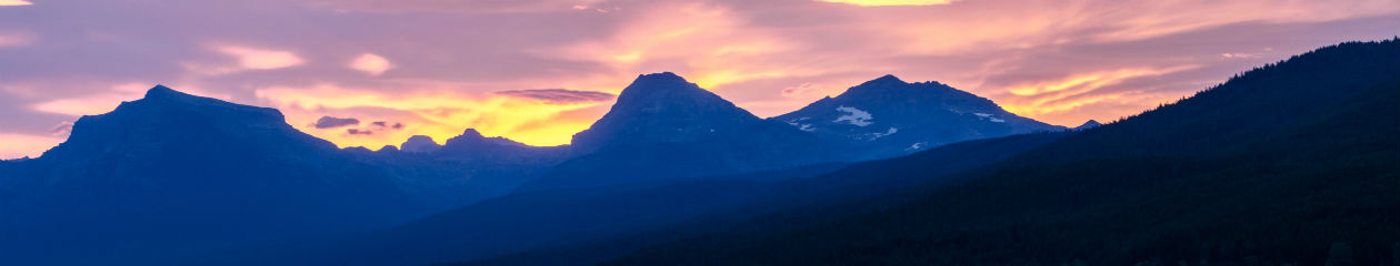
June 2010 visit to Kolob Canyons
I enjoyed a short visit to Kolob Canyons during a trip to Utah in June 2010. I drove to the end of Kolob Canyons Road and hiked the Timber Creek Overlook Trail. This was my first visit to a Utah park and I remember being totally awed by the beautiful and vast landscape. I photographed views with my first DSLR, a Nikon D60 with an 18-200mm lens. I’m not even sure I knew how to shoot on any setting other than fully Automatic at that time. The light was bright and not too contrasty, so getting the right exposure wasn’t too tough. I hadn’t looked at these photos for nearly 10 years when I pulled them out of my iPhoto folders and brought them into Lightroom and Photoshop to see if I could make them passable. What wonderful memories these brought back to me plus it made me realize how far my photography skills have progressed since then.


May 2013 visit to Zion National Park
I visited Zion in May 2013 during a 9-day road trip through Utah and northern Arizona. I went with a fellow photographer who I met at an RMSP (Rocky Mountain School of Photography) workshop in Glacier National Park the previous summer. My friend lives in Utah and organized the trip where we visited 4 National Parks, 3 State parks and slot canyons in Page, AZ. We had just visited Bryce Canyon so we approached Zion from the east. For the first part of the day, we drove slowly on the Zion-Mount Carmel Highway, stopping when we could to take photographs. One of my favorite areas was the Checkerboard Mesa. It was easy to see where it got its name.


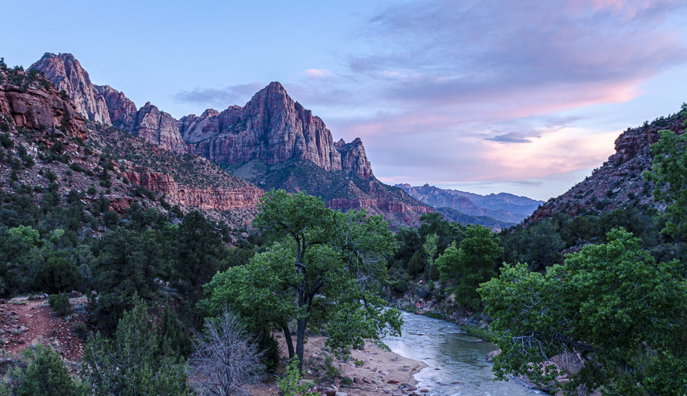
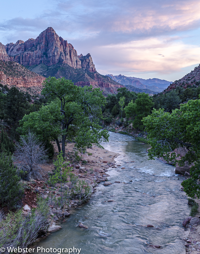
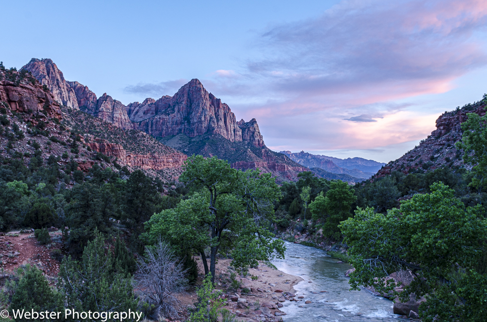
Once we reached the junction of Zion-Mount Carmel Highway and Hwy 9, we turned south towards Springdale where we were staying for the next 2 nights. We stopped to photograph the Virgin River which runs through Zion Canyon. I didn’t realize it at the time, but I would be seeing a lot of this beautiful river during our visit.


We continued on to the Watchman Trailhead and hiked the entire 2.7 miles r/t trail. It took us quite a while to complete the hike as I was stopping all the time to capture the breath-taking beauty all around me.


We saw beautiful views of the great Watchman Mountain as we continued on to our hotel.


We had a big day planned for the next day; our only full-day in the park. We had to board the Zion Canyon Shuttle near Canyon Junction and rode that to the Zion Lodge area so we could hike the Emerald Pools Trail (2.2 miles r/t). Zion Canyon Scenic Drive is accessible only by this shuttle bus during the busy season. We completed the entire hike despite getting caught in some heavy rain in the early afternoon. The rest of our hiking plans for the day were cut a bit short as a result.


Later that evening, we set out to capture what we hoped would be an iconic sunset photo. The rain earlier in the day created some beautiful cloud formations that really enhanced the sunset. We joined several other photographers with tripods on the bridge overlooking the Virgin River with Watchman Mountain in the background. I was extremely happy with the resulting photographs and later saw that this particular composition is highly iconic and used extensively in park literature, books, and websites.
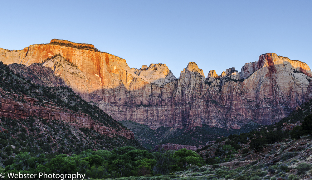
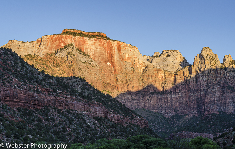
We got up very early the next morning to photograph the West Temple at sunrise. What a gorgeous, iconic square-topped mountain! This ended up being my next favorite set of shots from this trip.
Again, like I often say, I need to come back to Zion; 2 days was definitely not long enough!! I really would like to hike the iconic Narrows and at least part of Angels Landing along with several other hikes in the park.