
Great Smoky Mountains National Park is an U.S. National Park and a UNESCO World Heritage Site that straddles the ridgeline of the Great Smoky Mountains, part of the Blue Ridge Mountain chain, which are a division of the larger Appalachian Mountain chain. The border between Tennessee and North Carolina and runs northeast to southwest through the centerline of the park. This park is home to over 400 vertebrate species, 100 tree species, and 5000 plant species. Hiking is the park’s main attraction, with over 800 miles of trails, including 70 miles of the Appalachian Trail. (Source: Wikipedia)
Established: June 15, 1934
Size: 522,426 acres
Rank: 19
#Visitors in 2018: 11,421,200
(December 2017)- My fiance (at the time) and I spent one full day in the park on our way back from a visit with my parents who live in Charlotte, NC. You can’t do this park justice in just one day, but that was all we had for this visit. As we always do, we covered a lot of ground.
We stayed the night in Cherokee so we could get an early start. We entered the park from the south, with our first stop being the Oconaluftee Visitor Center. We got our park passport stamp and then walked around the Mountain Farm Museum-a collection of historic log buildings gathered from throughout the Smoky Mountains and preserved on a single site. Buildings include a house, barn, applehouse, springhouse, and smokehouse. (Source: NPS Website)


We continued up the road (Hwy 441/Newfound Gap Road) a short way and hiked around Mingus Mill, located at its original site. Built in 1886, this historic grist mill uses a water-powered turbine instead of a water wheel to power all of the machinery in the building.


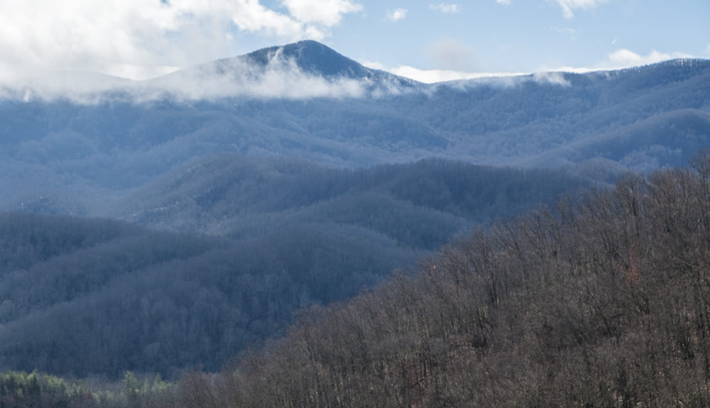
We continued driving north along Hwy 441, stopping often to take photos of trees in the misty conditions. It made for a very surreal scene. I got artsy with a few double exposure photos.


We stopped at the Tennessee/North Carolina state line where the Appalachian Trail crossed. We hiked a very short way on this trail, just to say we did it. I am in awe of those thru-hikers that complete the entire 2,190 miles. Apparently, each year, thousands of hikers attempt a thru-hike; only about one in four makes it all the way.


We continued on to the Sugarlands Visitor Center and then drove west on Little River Road to the Laurel Falls trailhead. We only had time to do one longer hike that day, so we chose this one. I love waterfalls, so this was a natural choice. Roundtrip, the hike to the 80-foot Laurel Falls and back is 2.3 miles, with a gain of roughly 314 feet in elevation. The waterfall consists of an upper and a lower section, divided by a walkway which crosses the stream (Laurel Branch) at the base of the upper falls. The falls receives its name from the mountain laurel that blooms along the trail and near the falls in May. There were a lot of people there, so it was hard to find a place to set up our tripods and get an appealing composition. The hike to the falls offered gorgeous and iconic views of the Smoky Mountains.


As with most parks, we need to return to explore and experience more of this park. We lucked out with the weather in December. There was very little snow in the park even at 5046 feet (TN/NC state line) and much fewer visitors than in the peak months.