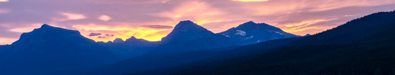
Guadalupe Mountains National Park is a U.S. National Park in the Guadalupe Mountains, east of El Paso, Texas. The mountain range includes Guadalupe Peak, the highest point in Texas at 8,749 feet , and El Capitan used as a landmark by travelers on the route later followed by the Butterfield Overland Mail stagecoach line.
Established: October 15, 1966
Size: 86,367 acres
Rank: 42
#Visitors in 2018: 172,347
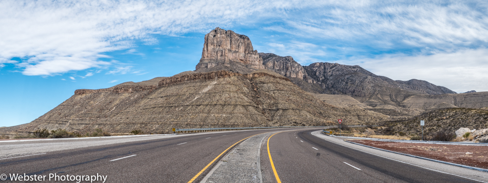
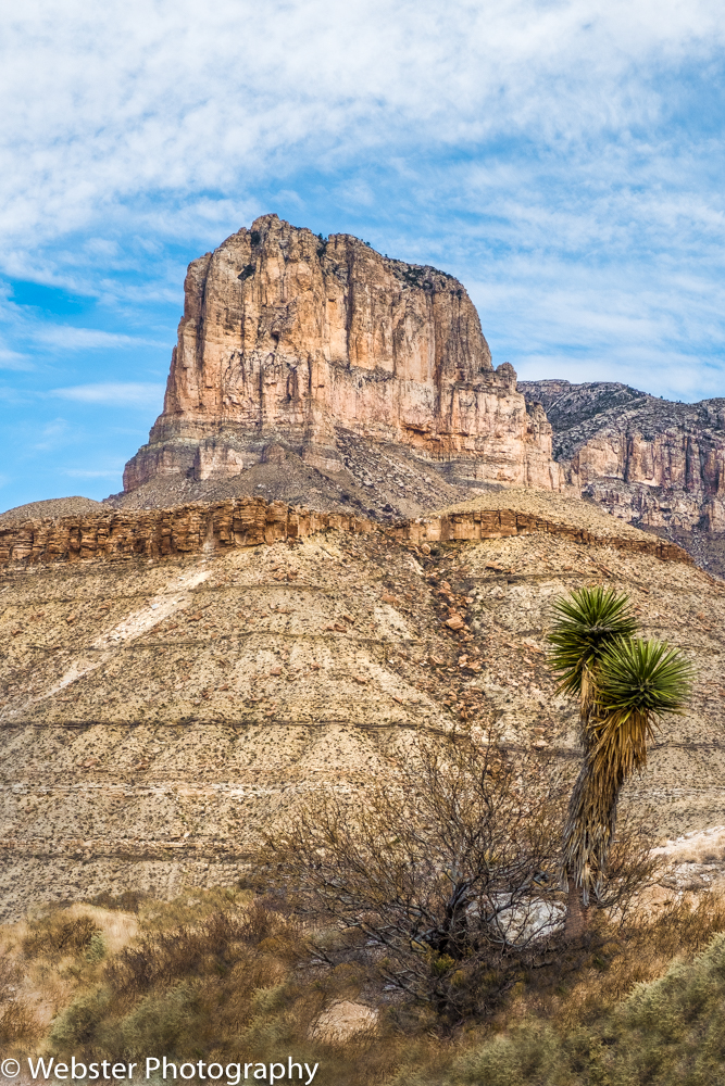
(Visited March 2018)- We visited Guadalupe Mountains National Park during our month-long RV road trip where we visited 11 National Park Sites which included 4 major National Parks. Prior to developing my interest in visiting all 59 (now 60) U.S. National Parks, I had never heard of Guadalupe Mountains NP. It is a pretty remote park, located on the border of west Texas and SE New Mexico. Its remote wilderness is what it is primarily known for. Like I try to do with all my park visits, I researched this park and learned that one of the iconic experiences for a day hiker like myself was to hike to the top of Guadalupe Peak, the highest peak in Texas at 8749 feet. I have climbed to higher elevations than this, but what made this particularly challenging was that it had a 2906 ft. elevation gain in 4.2 miles. We decided to make this our single goal for our first full day in the park. We arrived the day before our planned hike and were greeted by gorgeous views of El Capitan on the road leading to the park entrance. El Capitan (elevation 8085 ft.) is not as tall as Guadalupe Peak, but it’s iconic shape and prominence at the southern end of the Guadalupe Mountains makes for an impressive entrance to the park.


We pulled our RV into the Pine Springs Campground and luckily found a parking spot and then paid our $4/night fee. It is a real stretch to call this a campground; it is basically a parking lot next to the main trailheads for most of the major peak hikes in the park. There was a nice, clean restroom with sinks and toilets, but no showers or vending machines. We knew this in advance which is the main reason we rented an RV for this trip. We could be self-sufficient for several days in a row if needed. We relaxed, had a good dinner and went to bed early for our early start for our hike to Guadalupe Peak.
The hike was all we had hoped for… decent weather and spectacular views!! We decided to carry just one camera/lens combo (our Fuji XT-2 with 18-55mm lens) so we could make room for lots of water and food for the day while keeping it as light as possible. We enjoyed hiking through several different eco-systems such as the high desert and high elevation forests. There were a lot of steep switch-backs and areas where we had to scramble over rocks, all making it challenging and rewarding. Once near and at the top, we got many different views of El Capitan. While not the reason you climb to the summit, it is fun to find a stainless steel pyramid at the top, complete with a tin box with a journal in it for logging your accomplishment. It was a great spot to meet other people and share in the joy of reaching the top. A great memory from our particular ascent is that we ran into a young couple (Vic and Shovani) we met in Big Bend a few days earlier. Vic was a graduate of The Ohio State University as am I, so we decided this was the perfect place to do an iconic O-H-I-0!! What FUN!!!
A bit more info about the pyramid….. it was deposited on the summit by American Airlines to commemorate the 100th anniversary of the famed Butterfield Overland Mail Route which passed south of Guadalupe Peak. The stage route carried mail to southern California before the Pony Express ran in 1860 and 1861. One side has the American Airlines logo. The second side has a U.S. Postal Service recognizing the Butterfield riders. The third side has a compass with the Boy Scouts of America logo.


After a good night’s rest, we got up the next day to explore another area of the park. We had heard how beautiful McKittrick Canyon Trail was, so we made that our goal for the next day. It is supposed to be particularly spectacular in the Fall. Before hitting the trail, we explored the Frijole Ranch for a while. The ranch was built about 1876 by the Rader Brothers in the Guadalupe Mountains next to Frijole Spring and comprises seven buildings: the ranch house, a bunkhouse, a barn, a double outhouse, a springhouse, a shed, and a school house, most of which were built with local stone rubble. The complex represents the most complete early ranching operation in the Guadalupe Mountains. The buildings were closed while we were there, so we just walked the grounds.


We went on from there the McKittrick Canyon Trail with the goal to hike to the Pratt Cabin and back; a 5 mile round trip hike. It was considerably flatter and easier than the Guadalupe Peak Trail, so it offered us a chance to recuperate while seeing another interesting eco-system and piece of history. In 1921, Wallace Pratt, a geologist for Humble Oil and Refining Company, was impressed by the beauty of McKittrick Canyon and bought the land to build two houses there. Both were used as summer homes by Pratt and his family up until 1960. Wallace Pratt donated about 6,000 acres of McKittrick Canyon which became part of Guadalupe Mountains National Park in 1972.


We finished our canyon hike feeling very satisfied about our time at Guadalupe Mountains National Park. I’m not sure we would have visited had I not had the goal to visit all 60 U.S. National Parks, but I’m so glad we did. The adventure in getting to some of our parks and then making the very most of our visit is a huge part of the fun of this great adventure!