(Update: As of December 20, 2019, White Sands became a National Park)
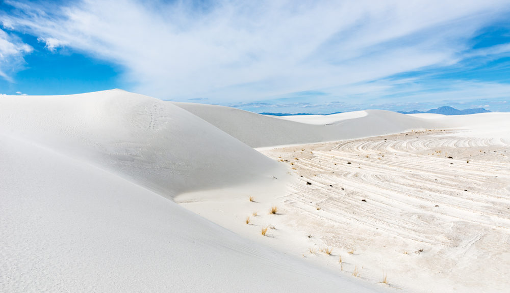
On January 18, 1933, President Herbert Hoover designated White Sands National Monument, acting under the authority of the Antiquities Act of 1906. At the northern end of the Chihuahuan Desert lies a mountain-ringed valley, the Tularosa Basin. Rising from the heart of this basin is the largest gypsum dune field in the world (275 square miles). Gypsum (hydrous calcium sulfate) is rarely found as sand because it is water soluble. Rain and snow in the mountains dissolve gypsum from the rocks and carry it into Tularosa Basin. Rivers would usually carry dissolved gypsum to the sea, but no river drains this basin. The water, with the gypsum and other sediments is trapped in the basin. Strong winds constantly cause the dunes to grow and shift. Source: Wikipedia and National Park brochures
Established as a U.S. National Park: December 20, 2019
Size: 146,344 acres
Rank: 37
#Visitors in 2018: 603,008
I normally only write travel stories about my trips to the 60 major U.S. National Parks only because there are 418 U.S. National sites (includes the major parks plus many other sites) and I just have to draw the line somewhere. BUT…. some of these 418 sites are worthy of a blog post and White Sands is one of these.
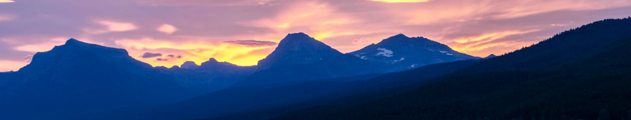
We spent a day and half on the dunes, photographing the various shapes and textures of the dunes. We found photographing the dunes to be quite challenging due to the lack of contrast, especially during the brightest part of the day. Once the sun started going down, we were able to use the shadows to create the contrast. The Interdune Flats (the hard-packed, textured flat areas between dune fields where most of the vegetation grew) also helped provide some needed contrast. The pink and blue colors of the sunset provided a different type of contrast.
Hiking on the dunes was quite an experience. While there are posts situated along the “trail”, you really can walk anywhere. The posts (or alternatively GPS) are needed to guide you back to your car. There is an 8-mile Dunes drive that provides access to various trails. Only the first 5 miles are paved, but the last 3 miles are hard-packed gypsum that is “plowed” to keep the road clear and firm. Another interesting aspect of this park is that camping is allowed in designated areas in the dunes. We did hikes from the boardwalk, Alkali Flat Trail and Backcountry Camping Loop Trail during our day and half in the park. We wanted to get out into the larger dune fields to get away from the crowds of people who were sledding down the steep sides of the dunes. This seemed to be a key highlight for visitors here which was fine with us because they tended to stay much closer to the parking areas.
Hiking on gypsum sand is quite a bit different from regular silica-based sand; a bit easier, I think. During the bright sunshine, the white sand created a blinding effect. Add in the high, diffuse dense cloud cover we had on the second day, it felt like we were in a “white-out”. We were there during a relatively cool time of year; I can’t imagine what it would be like when it was really hot!


We were disappointed to learn that the park closed at 8 pm. This posed a bit of challenge for us as we really had to hustle to get out of the park while still getting some sunset photos. We knew this in advance, so during the day, we scoped possible sunset locations that were close enough to our car and which would allow us to hike back and leave the park before the gates closed. All went well!


