My husband and I spent nearly a week exploring the Outer Banks of North Carolina as a side trip while visiting my mom in Charlotte. We took a long path to get there, first going to Asheville, then Raleigh, then to the Outer Banks starting from the north end. We traveled clockwise from Nags Head area to Beaufort, driving our car on Hwy 12 as far as Hatteras, then taking a car ferry to Ocracoke and another car ferry to Cedar Island and then driving back to Charlotte via Beaufort and Currie. We made reservations in advance at B&B’s along the way. Our favorite 2 places were Collington Creek Inn in Kill Devil Hills and Thurston House Inn in Ocracoke.
As we often do on our road trips, we looked for other National Park sites to visit along the way. The first one we visited was Fort Raleigh National Historic Site on the northern tip of Roanoke Island. Fort Raleigh NHS preserves the location of Roanoke Colony, the first English settlement in the present-day United States. The site was preserved for its national significance in relation to the founding of the first English settlement in North America in 1587. (Source: NPS Website). Visiting national park sites offers a wonderful opportunity to learn more about our U.S. history; something I wasn’t particularly interested in when I was young.


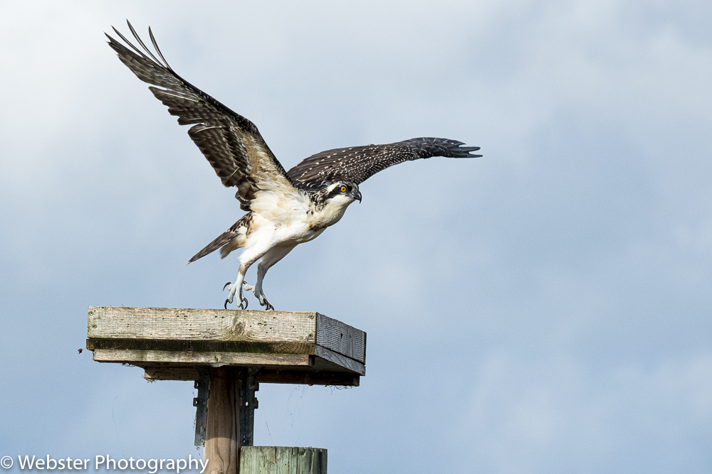
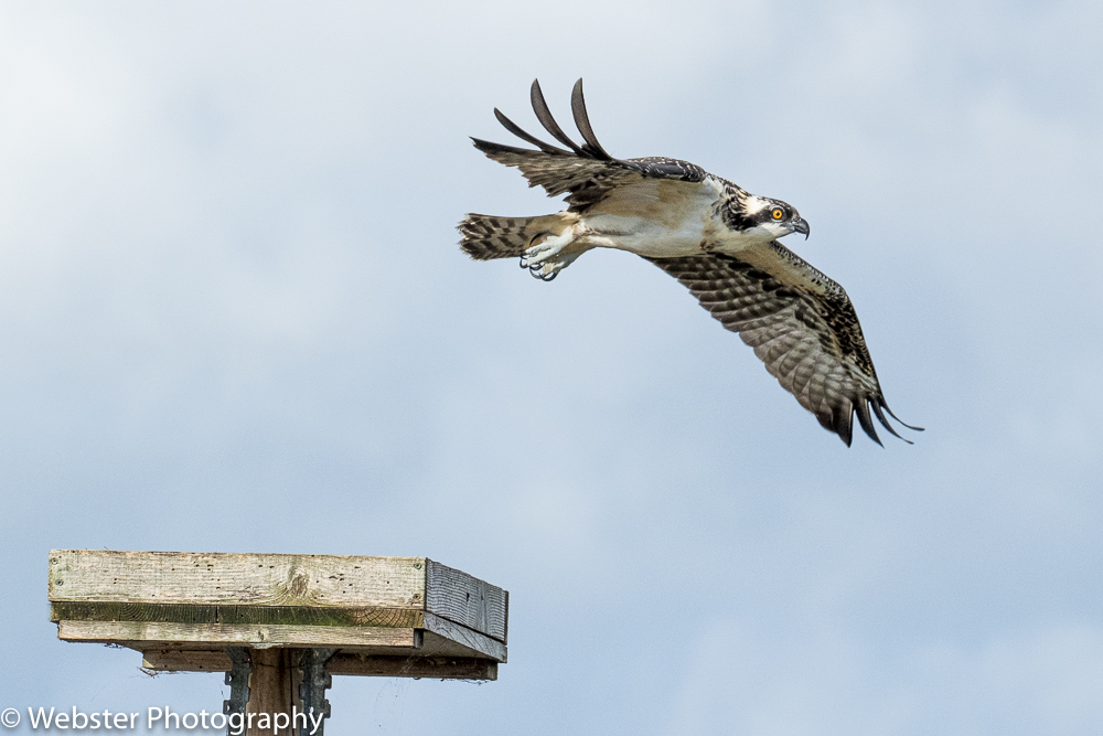
We then drove to Kill Devil Hills and checked into our B&B. We nearly had the place to ourselves, but it wouldn’t have mattered much because this place was huge and had so many choices of enclosed decks and indoor gathering spaces. The owners were delightful and the cooked breakfast was delicious!! They also had an osprey nesting platform and we enjoyed watching the ospreys come and go at various times of the day.
After a leisurely morning, we checked out, after regrettably spending only 1 night at Collington Creek Inn and headed north to the Kill Devil Hills/Kitty Hawk area to visit the Wright Brothers National Memorial. Wright Brothers National Memorial commemorates the first successful, sustained, powered flights in a heavier-than-air machine. The monument itself and the first flight boulders are amazing in themselves, but the displays inside the Visitor Center are not to be missed.


After our visit to the Wright Brothers NM, we started heading south towards the Cape Hatteras National Seashore. Our next stop was Jockey Ridge State Park in Nags Head. Jockey Ridge is home to the largest natural active sand dune system in the eastern U.S. We hiked around the dunes and watched several people learning to hang glide.


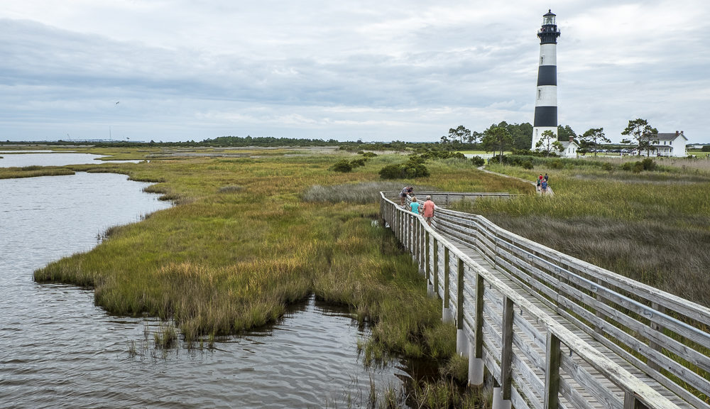
Next stop as we drove south was the Bodie Island Light Station and the surrounding marshland. The 165 ft. tall lighthouse was completed in 1872. It is open to the public for climbing, but only 10 people at a time are allowed. We arrived too late to get in the queue for the day. We loved this picturesque lighthouse and tried to capture it from various perspectives as we hiked around it.


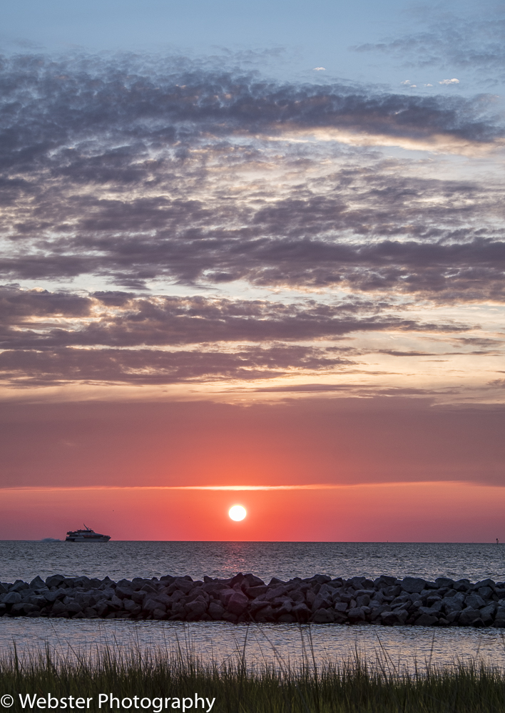
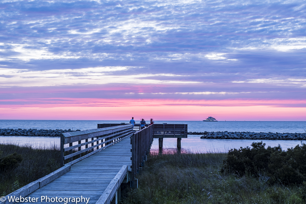
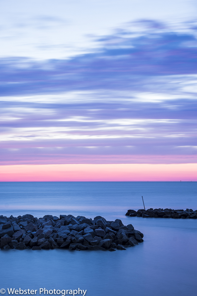
We continued driving south and finally reached the entrance of the Cape Hatteras National Seashore just beyond Pea Island National Wildlife Refuge. It was too late in the day to enjoy the wildlife refuge, so we continued on to our destination for the next 2 nights; Avon. We stayed at a B&B overlooking Pamlico Sound and enjoyed some gorgeous sunsets from the deck of our B&B as well as from a local restaurant.


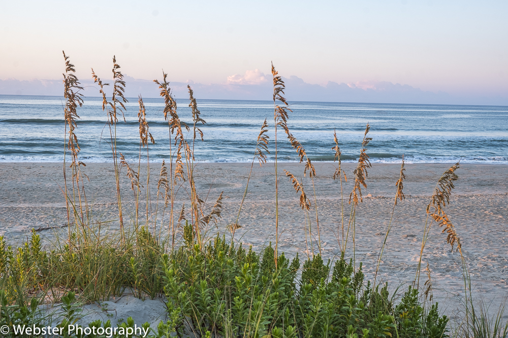
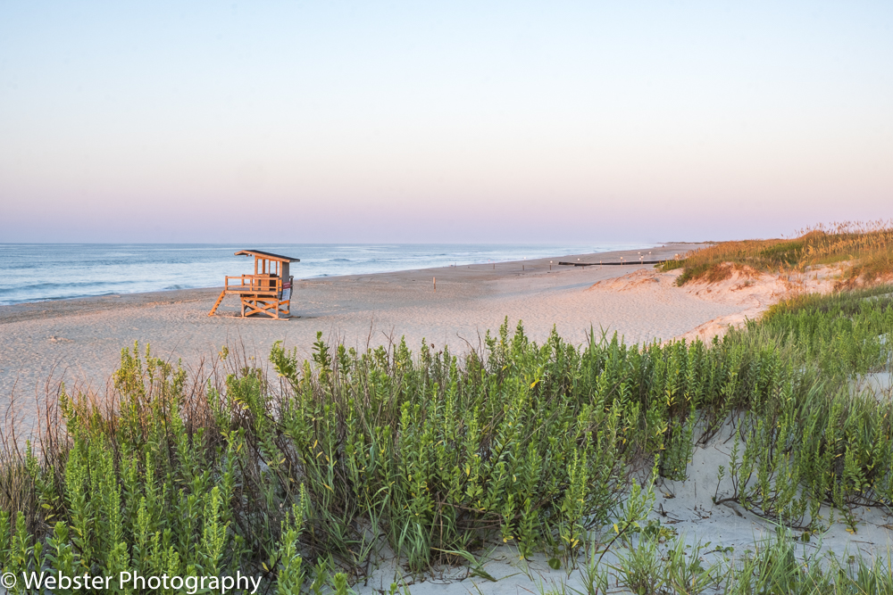
Using Avon as a base for the next 2 days, we drove north and south to see various sight, as nothing was very far. We stopped often along the way to walk the beach and capture photos of the dunes, sea oats, and shore birds. These photos capture what I imagined the Outer Banks to be before my visit; the iconic Outer Banks!


We visited Cape Hatteras Lighthouse twice during our visit. Our first visit was late in the day. The next day, we bought tickets to climb to the top.


One of the coolest and surprising things we saw while exploring the Outer Banks was the Chicamacomico Life-Saving Station in Rodanthe. With its two stations and five outbuildings, Chicamacomico Life-Saving Station is the most complete site of all remaining life-saving stations in North Carolina and one of the most complete sites in the nation. It is a wonderful historic site that gives tons of information about an overlooked group of men: the members of the US Life-Saving Services who risked their lives to rescue travelers in peril on the North Carolina Coast. At one time, there were 16 life-savings stations located along the NC Coast which eventually become blueprints for the modern U.S. Coast Guard. We were lucky enough to visit in time to see the weekly Historic Reenactment of the Beach Apparatus Drill. (Source: https://chicamacomico.org/).


We also visited Pea Island National Wildlife Refuge from our base in Avon. Pea Island National Wildlife Refuge was established in 1938 to provide nesting, resting, and wintering habitat for migratory birds; to provide habitat and protection for endangered and threatened species, such as Loggerhead sea turtles; and to provide opportunities for public enjoyment of wildlife and wildlands resources. (Source: https://www.fws.gov/refuge/pea_island/)
We enjoyed hiking all around the ponds with views of Pamlico Sound. We saw lots of different types of water fowl and turtles.


Our time on Cape Hatteras Island came to a close and it was now time to travel south to Ocracoke Island, still part of the Cape Hatteras National Seashore. We took a free car ferry from the town of Hatteras to the east end of Ocracoke Island.


We drove Hwy 12 from the ferry dock to the the town of Ocracoke, about 14 miles. There was really nothing in between except some beach access points. Once in Ocracoke, we checked into our B&B and then went exploring. We LOVED Ocracoke. It had a very quaint, quiet, touristy feel! We were so glad we booked 2 nights at the Thurston Inn which was delightful!! Our first exploration took us to the 65 foot Ocracoke Lighthouse, built in 1823. We were not able to climb to the top, but the base was open and we were able to look up the spiral staircase.


After dinner, we drove back down town to capture the sunset over Pamlico Sound.
The next day, our only full day in Ocracoke, we booked a boat tour to Portsmouth Village, located in the northern end of Cape Lookout National Seashore. We departed from Silver Lake Harbor for the village. Our boat captain (Portsmouth Island Boat Tours) had special permission to open the Visitor Center and act as a tour guide for us. For the most part, that meant allowing us to wander around the village for a little over an hour. It was a fascinating place, very well preserved and maintained by the National Park Service. The village was created in 1753 and by 1770, it had grown to be one of the largest settlements on the Outer Banks; first by providing access to inland towns via the Ocracoke Inlet and then as a bustling sea village. By 1860, there were 685 residents but many residents left during the Civil War, never to return. By 1956, there were only 17 residents left and by 1971, the last two residents, Elma Dixon and Marian Babb reluctantly left for the mainland.


After visiting the village, our boat captain took us to a beach along Ocracoke Inlet. Getting on and off the boat was a bit challenging as there was no dock; he had to beach it while maneuvering the waves. Some people chose not to go and instead were ferried back to Ocracoke. We enjoyed some solitude, a little wading and lots of bird watching. On the way back to Ocracoke, our boat captain “mumbled” a lot of history of the area…. we understood every 4th word or so :).


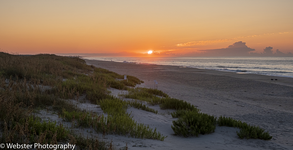
We got up very early the next morning to catch the sunrise on the Atlantic side of the seashore a few miles north of Ocracoke. We had checked out our photography spot the day before, so we knew where we wanted to go. It is a bit challenging to find a good foreground or background along the seashore with nothing but open water out beyond.
We drove back to the Thurston Inn for a delicious cooked breakfast on the porch, then checked out and headed to the ferry dock where we picked up our car ferry to Cedar Island on the mainland. Cape Lookout National Seashore is more remote and difficult to visit than Cape Hatteras NS because there are no roads. It is one of the few remaining undeveloped barrier island systems in the world. Once we disembarked on Cedar Island, we drove to Cape Lookout National Seashore Visitor Center to get our park passport stamped and to buy tickets for the Island Express Ferry to Cape Lookout Lighthouse. On the way to the lighthouse, we saw some of the famous horses of Shackleford Banks. Shackleford Banks is home to about 110 wild horses, originally introduced by European explorers in the 1500’s.

We docked near the Cape Lookout Lighthouse and we immediately walked to the lighthouse to obtain tickets to climb to the top. This was another beautiful lighthouse with its black and white diamond pattern. This lighthouse, built in 1859, stands 163 feet. The view from the top was beautiful.


After our visit to the lighthouse, we continued on to Beaufort to check into our B&B. Beaufort was a very pleasant surprise!! Beaufort is North Carolina’s 3rd oldest town; originally a fishing village and port of safety dating from the late 1600’s. The village was visited by sailors, pirates, merchants and skilled craftsmen who built Bahamian and West Indian style homes and public buildings. More than 150 of these have been restored and have plaques with names and dates of construction. We took a Historic Building Tour via a double decker bus. We also visited the Old Burying Ground.


We left Beaufort to start our return to Charlotte, looking for additional stops along the way. As we always do, we try to visit National Park sites. We chose to divert a bit to Currie NC to visit Moores Creek National Battlefield. This is an 87-acre park that preserves the site of the Revolutionary War Moores Creek Bridge battle fought in February 27, 1776, between loyalists supporting the British Crown and patriots of NC.


We really enjoyed this road trip!! We saw 5 national park sites in all along with some other really wonderful sites. Together with our initial diversion to Asheville and Raleigh it was an action-packed 10 days! We were a little concerned about visiting the Outer Banks in the summer, but we were pleasantly surprised that it was not overly crowded. It was really hot, but the ocean breezes made it perfect! Great memories and a desire to return…. nothing better!!