
Death Valley National Park is an U.S. National Park that straddles the California-Nevada border, east of the Sierra Nevada. The park boundaries include Death Valley, the northern section of Panamint Valley, the southern section of Eureka Valley, and most of Saline Valley. The park occupies an interface zone between the arid Great Basin and Mojave deserts, protecting the northwest corner of the Mojave Desert and its diverse environment of salt-flats, sand dunes, badlands, valleys, canyons, and mountains. Death Valley is the largest national park in the contiguous United States, and the hottest, driest and lowest of all the national parks in the United States. The second-lowest point in the Western Hemisphere is in Badwater Basin, which is 282 feet below sea level. Approximately 91% of the park is a designated wilderness area. The park is home to many species of plants and animals that have adapted to this harsh desert environment. Some examples include creosote bush, bighorn sheep, coyote and the Death Valley pupfish, a survivor from much wetter times. (Source: Wikipedia)
Established: October 31, 1994
Size: 3,408,406 acres
Rank: 5
#Visitors in 2018: 1,678,660
(March 2017)- My fiance and I spent a week in Death Valley National Park near the end of the “cool” season. From all that we read, Death Valley is not a particularly pleasant or safe place to visit in April-October due to the heat. Since we like to hike, explore, and photograph, we knew we needed to avoid that time of year. We also knew from our research that 1 week was a good start, but due to the sheer size and diversity of this park, we would still leave many parts unexplored. In addition, there were sections of the park we wanted to visit, but were closed due to flood damage. Even a half inch of rain during a short duration can wreak havoc in this parched landscape. The areas we had hoped to visit, but couldn’t were Artist’s Palette, West Road, Titus Canyon, and Scotty’s Castle. We knew about Scotty’s Castle being closed as it has been since October 2015. Extensive repairs are underway, but the historic landmark is not expected to be reopened until 2019. We were not terribly disappointed to miss Scotty’s Castle as we came for the natural beauty of the park. We were very disappointed about the other 3 closures, however, but it did force us to explore some other areas that were not originally part of our itinerary.
We flew into Las Vegas and rented a mid-size, 4-door sedan and drove to Death Valley. We entered the park from the east on 190. Although not in the park, our first stop was in Death Valley Junction to see the historic Amargosa Opera House. For more than 40 years (starting in 1968), Marta Becket, a former Radio City and Broadway dancer lived and shared her art in this tiny desert town. The most interesting attraction are the walls and ceilings that are filled with murals of adoring audiences that Marta painted by herself over a 6-year period. The opera house still hosts life performances today.


After our stop in Death Valley Junction, we continued on to the park and Furnace Creek Lodge, our home for the first 4 nights. We quickly checked into our room, grabbed our camera gear, and headed out to catch our first sunset. We made it as far as Devil’s Golf Course, a large salt pan on the floor of Death Valley. It was a short drive from Furnace Creek, so after shooting some sunset photos, we returned to grab a quick dinner and then drove back down to see if we could capture some star trails. Our hope was to capture lots of great star trails during our week since Death Valley is a dark skies park. Unfortunately (due to a waxing moon and our tired bodies), we did not get a chance to improve on the photo below. It is not the best, but since I just love star trails and the challenge of shooting them, I included it here.


Our first full day in Death Valley was spent south of Furnace Creek. It started with a sunrise at Zabriskie’s Point, followed by a drive through 20 Mule Canyon. We drove up to Dante’s View in the early afternoon where we experienced a spectacular view of the valley from the east side. We timed it so we could drive down to Badwater Basin early enough to scout a good spot to take sunset photos. We were pleasantly surprised to find Badwater Basin filled with water. It was very shallow (only a few inches deep) for the distance we hiked out. We were expecting to photograph the iconic hexagonal-shaped salt formations, but instead were treated to some wonderful reflections. Apparently, we were very lucky to experience this- there usually isn’t much water to be found anywhere in Death Valley.


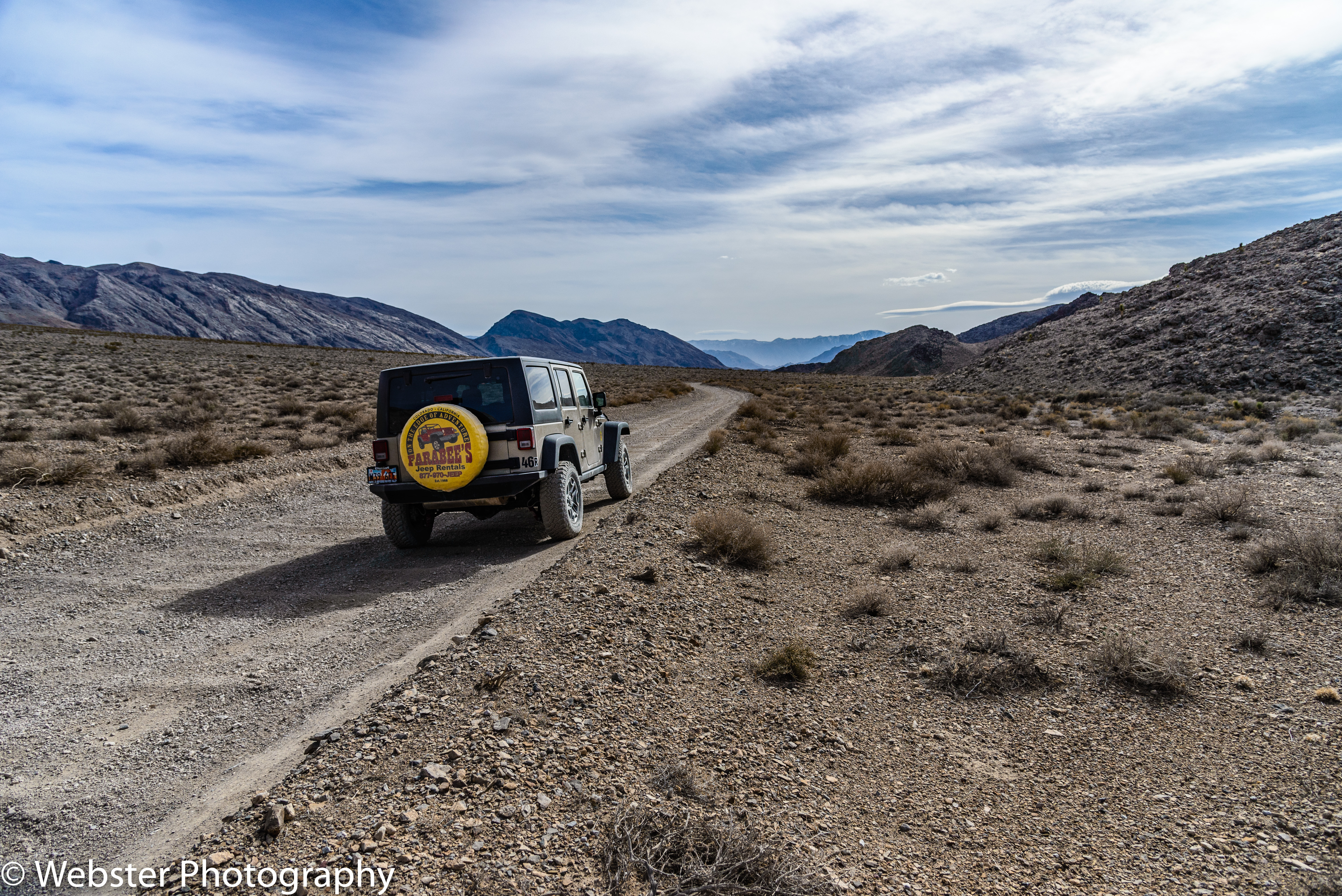
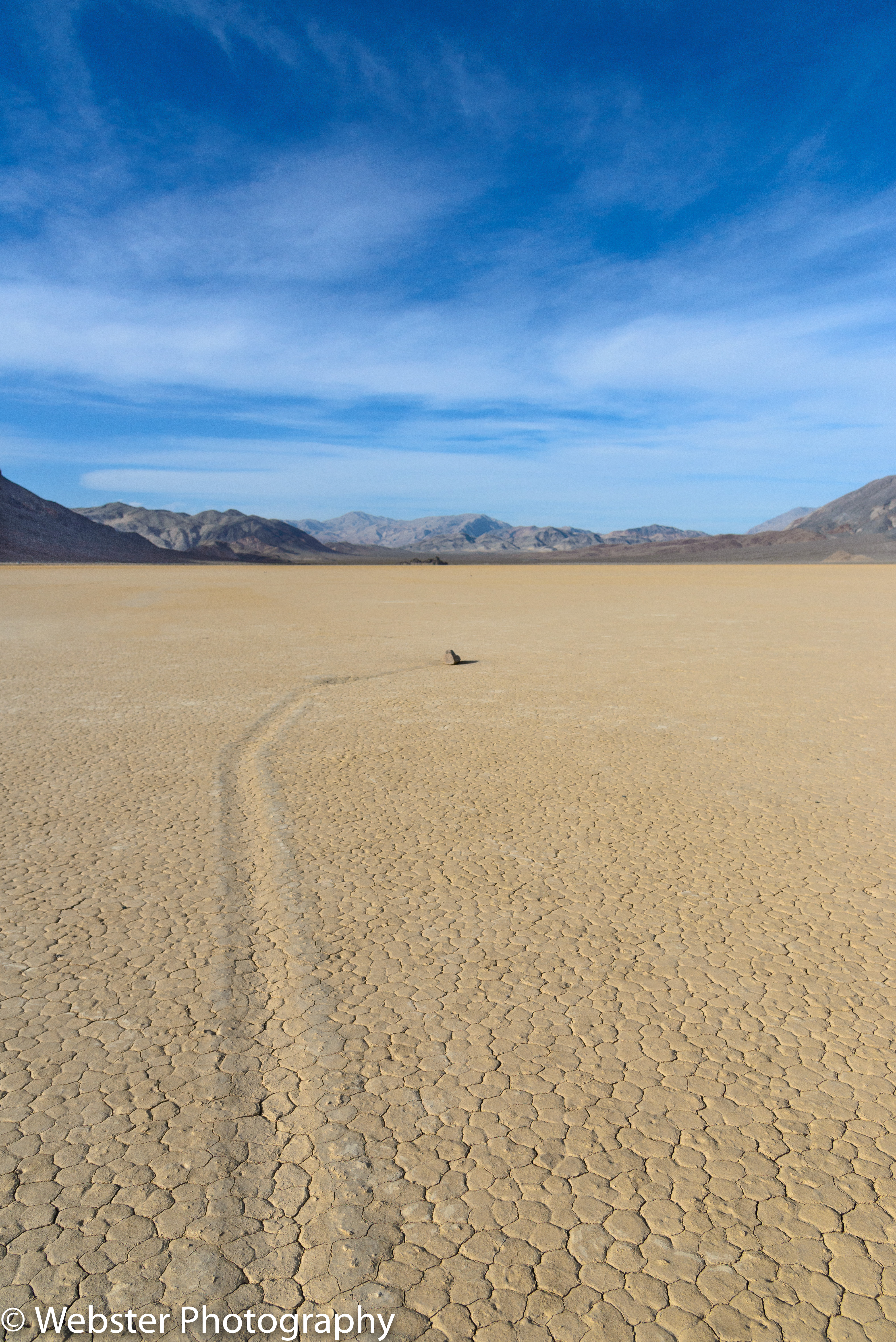
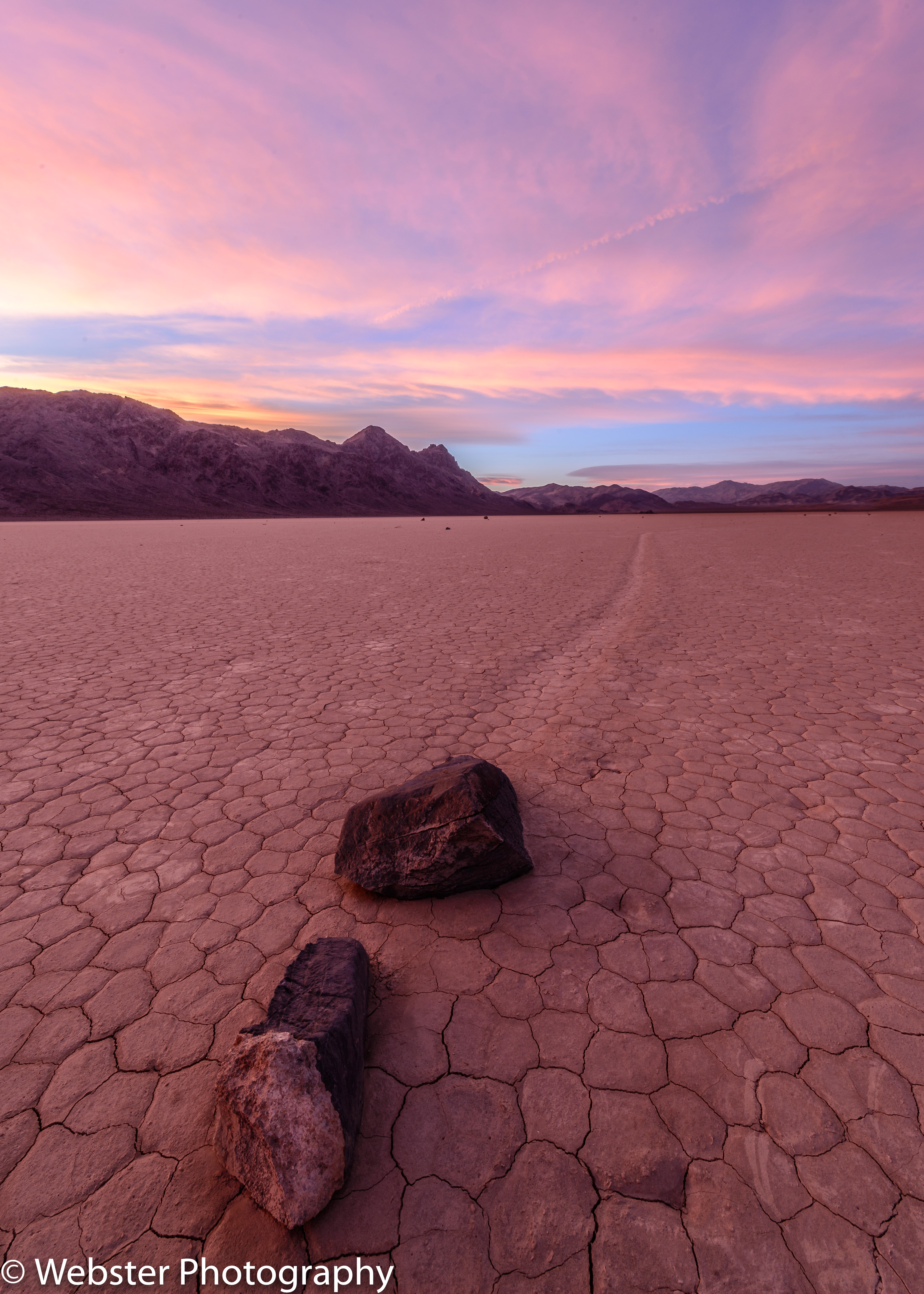
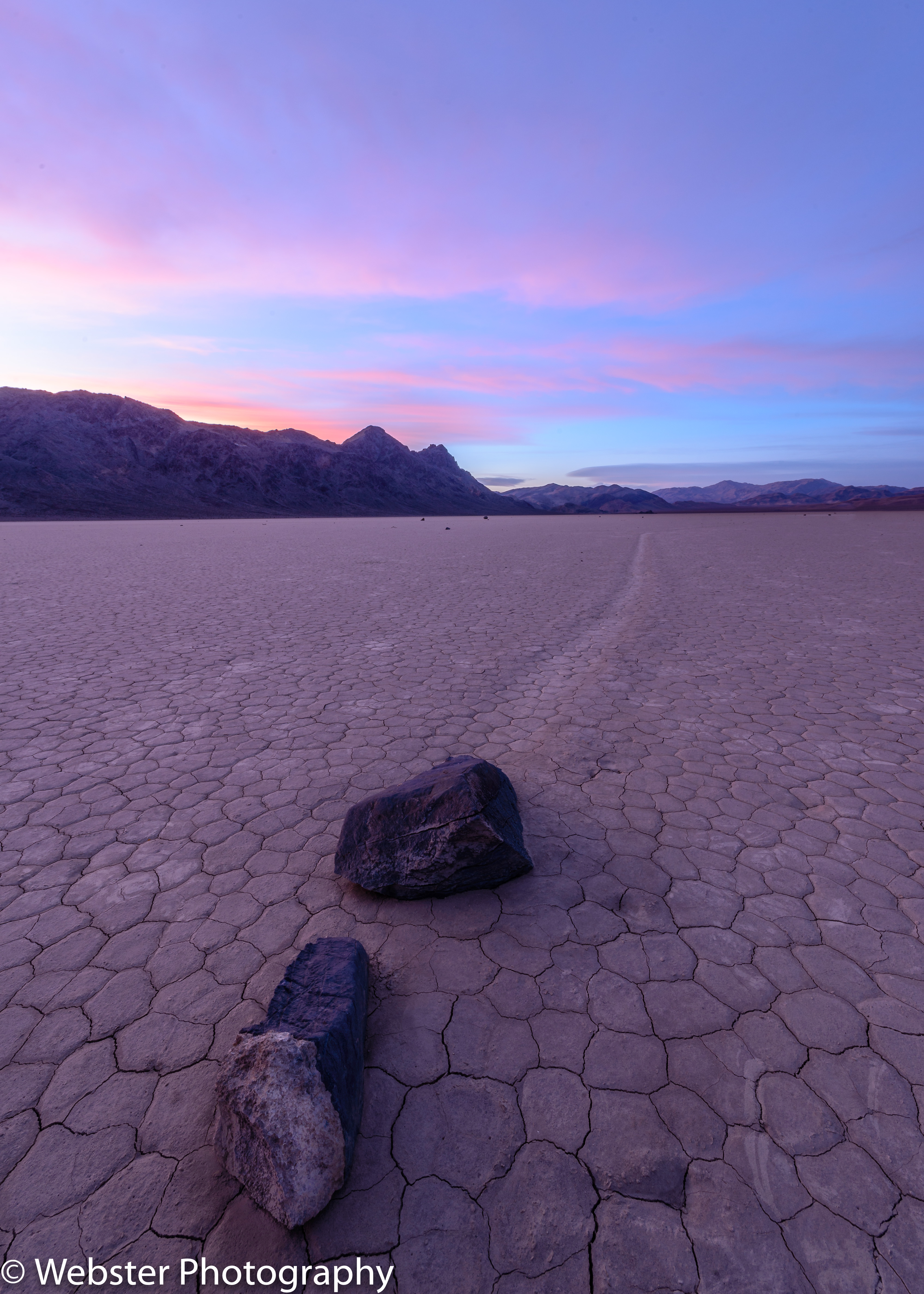
We set off on a big adventure on Day 2. We reserved a 4×4 Jeep at Farabee’s a few months in advance of our trip so we could drive to the Racetrack. Our goal was to capture the mysterious Moving Rocks that are concentrated near the south end of the huge playa. We wanted to photograph the rocks at both sunset and sunrise, which meant that we had to stay overnight. We did not have any camping gear with us, only an extra blanket and pillows that we borrowed from our hotel room. As it turned out, we experienced gale-force winds (gusts up to 60 mph) during our entire visit. It ended up being a good thing that we “slept” in our jeep, as no tent would have stayed in place. But before even reaching the Racetrack, we stopped to explore the Ubehebe Crater, located at the end of the paved Scotty’s Castle Road. It was pretty spectacular! We braved the high winds and hiked down to the bottom of the crater. The colors, textures, and patterns of the crater walls and floor were fabulous and so fun to photograph.


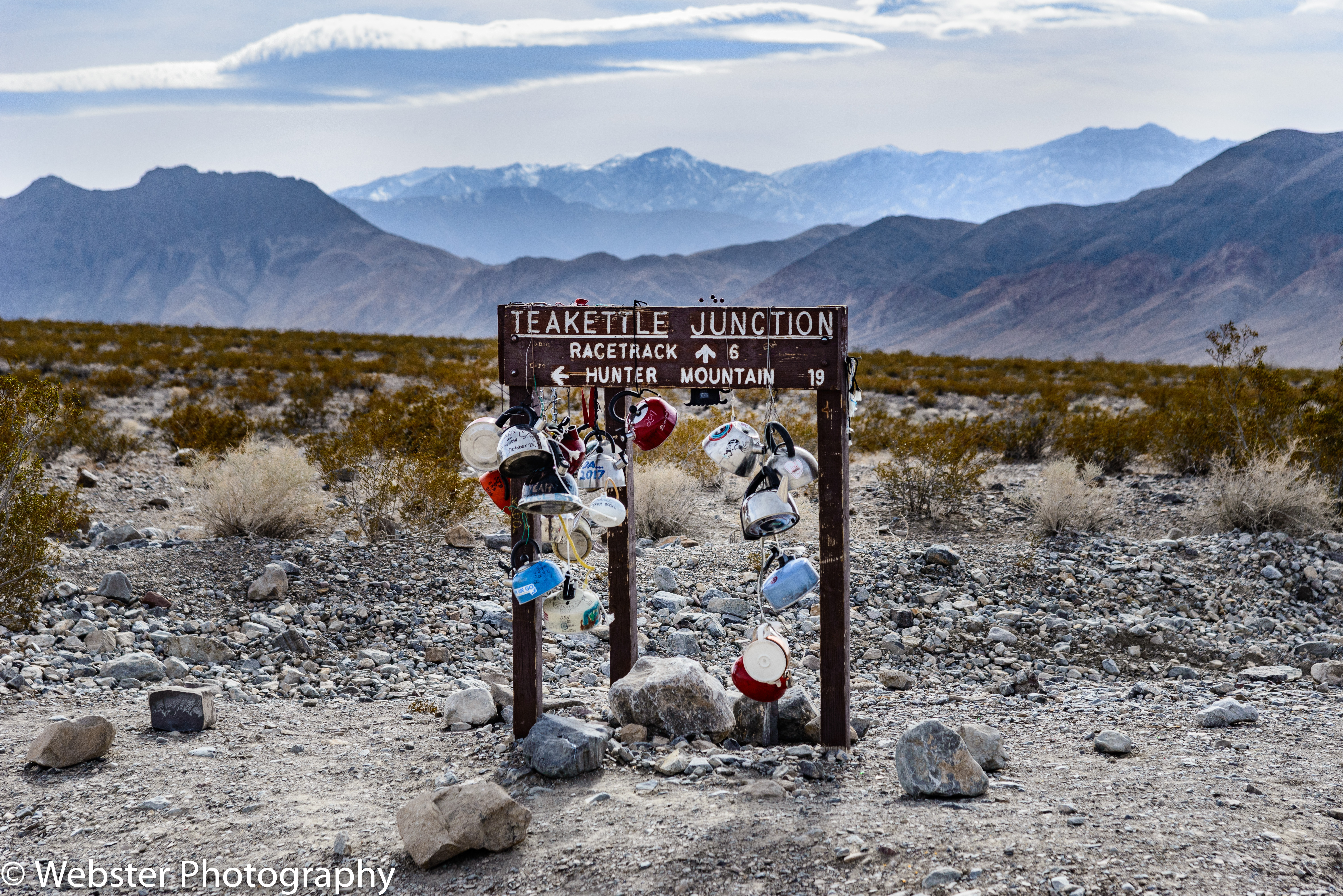
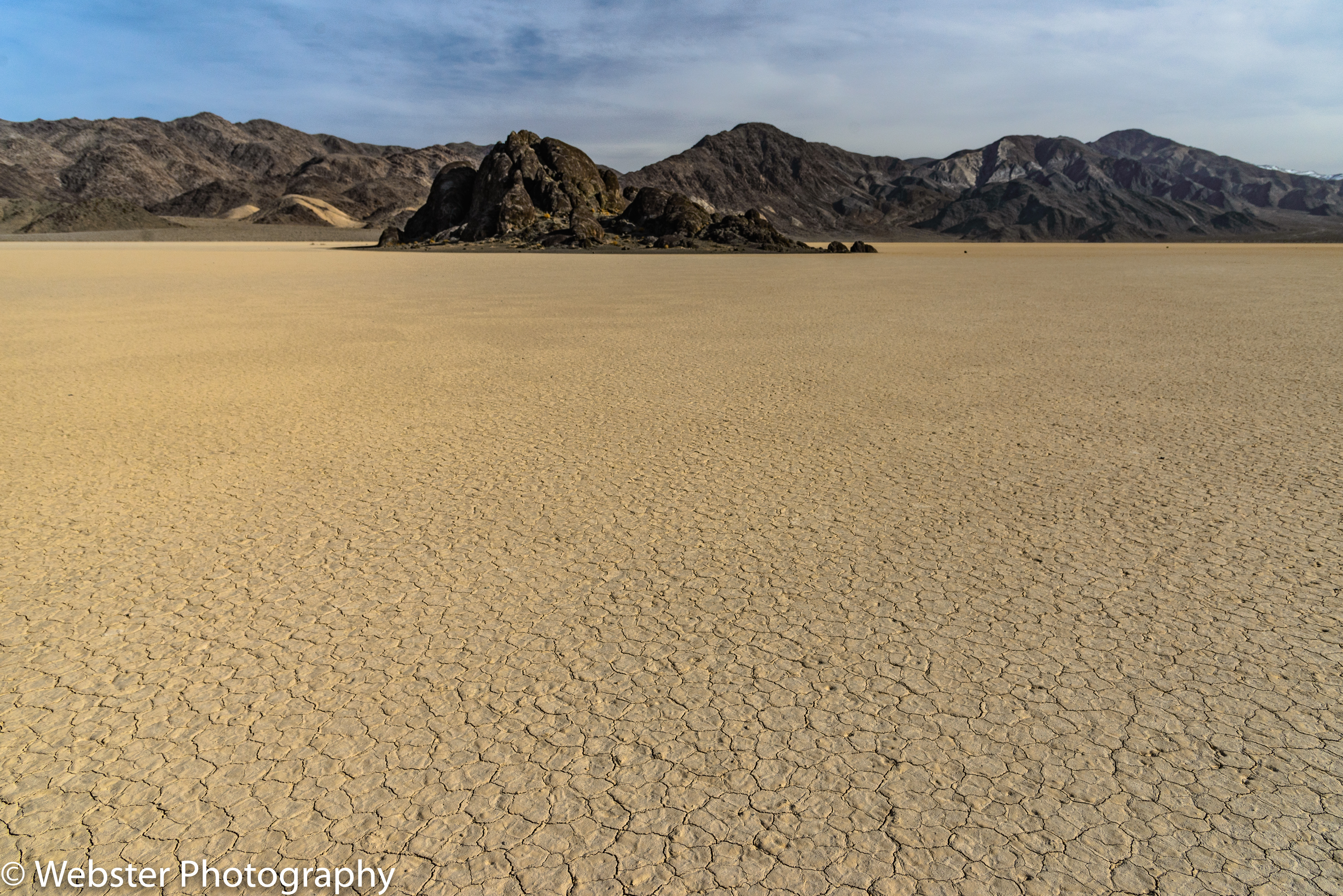
After exploring Ubehebe Crater, we started the 27-mile trek down Racetrack Road, a rough, dirt road. The estimated time to drive one-way was 3 hr. and it was about right! The first stop we made was at Teakettle Junction where people attach tea kettles of all kinds to the sign marking the junction to Racetrack and Hunter Mountain; a fun little oddity. Our next stop was The Grandstand, large island outcrop of black rocks (quartz monzonite) which creates a sharp contrast against the large flat, tan-colored playa. We hiked out to The Grandstand and back, anxious to venture on to see the Moving Rocks at the south end of the playa. We spent about an hour scoping out “the rock” we wanted to photograph at sunset. We found two rocks close to each other with the trail moving away from us. We set our tripods down close to the ground and within 6-8 inches of the closest rock and shot with our ultra-wide angle lenses. Luckily, the low position and sturdiness of our tripods withstood the high winds and we were rewarded with a beautiful sunset. We took photos before sunset and at various times throughout the golden and blue hour. It is quite spectacular to see the change in tones in the series of photos below.


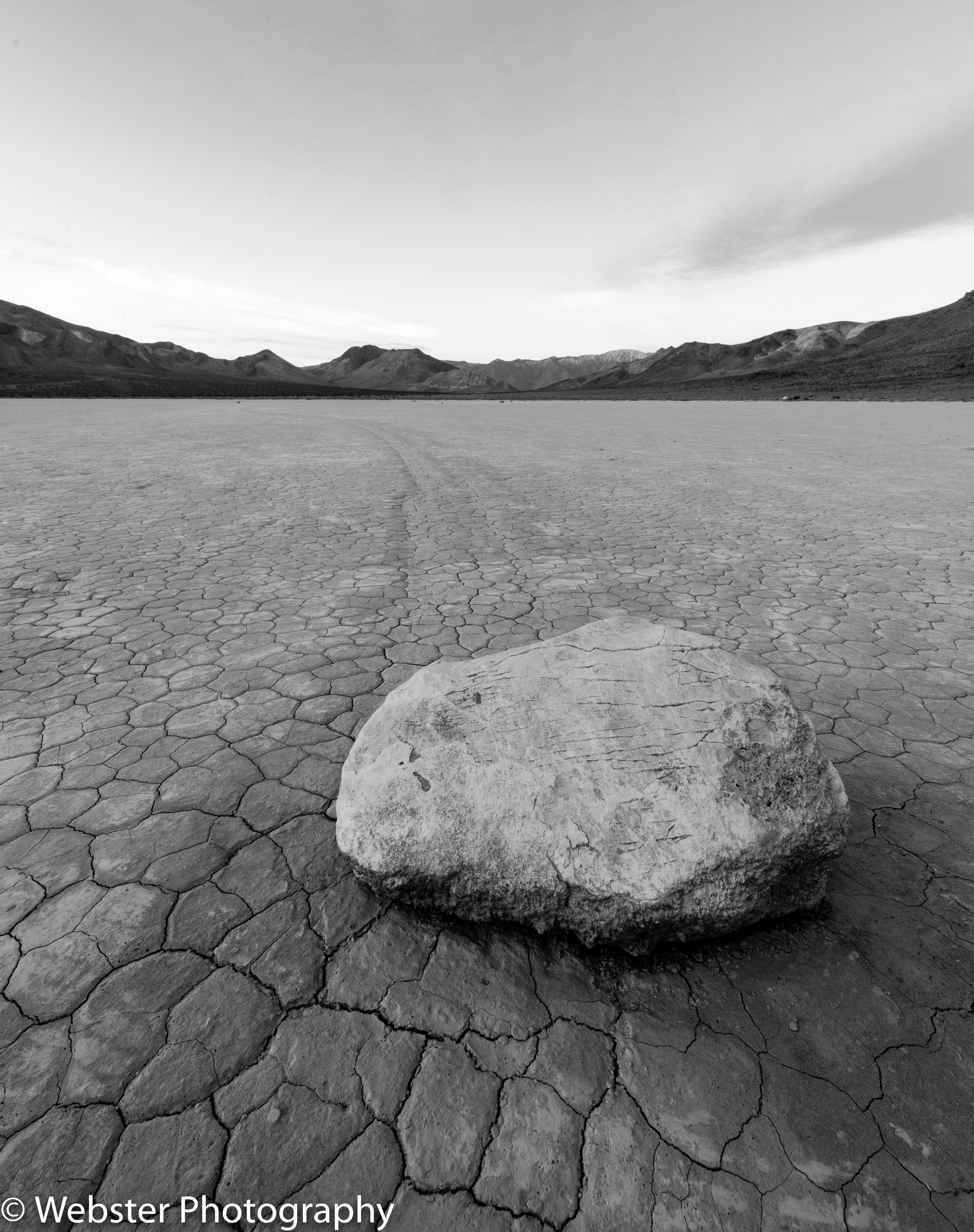
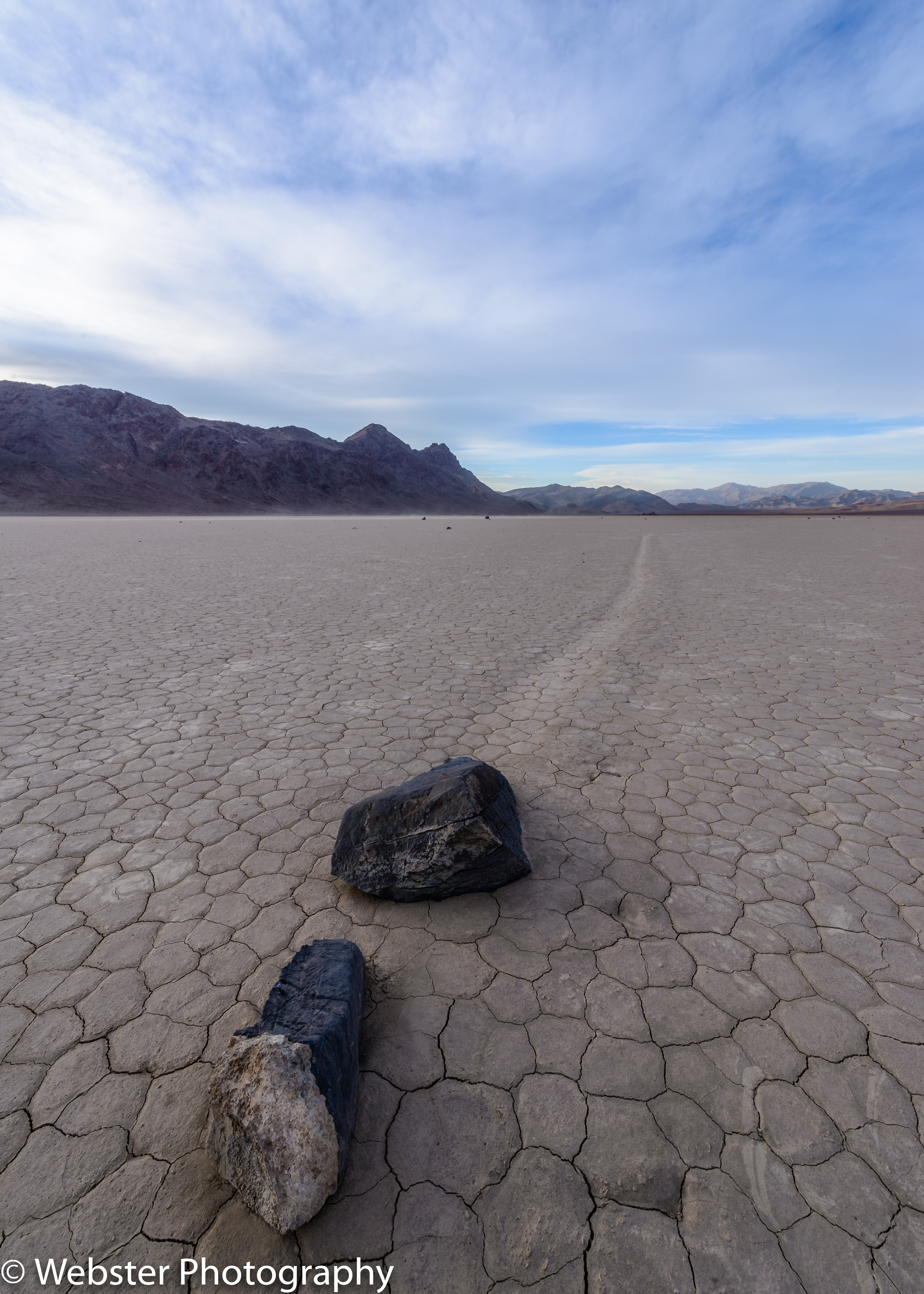
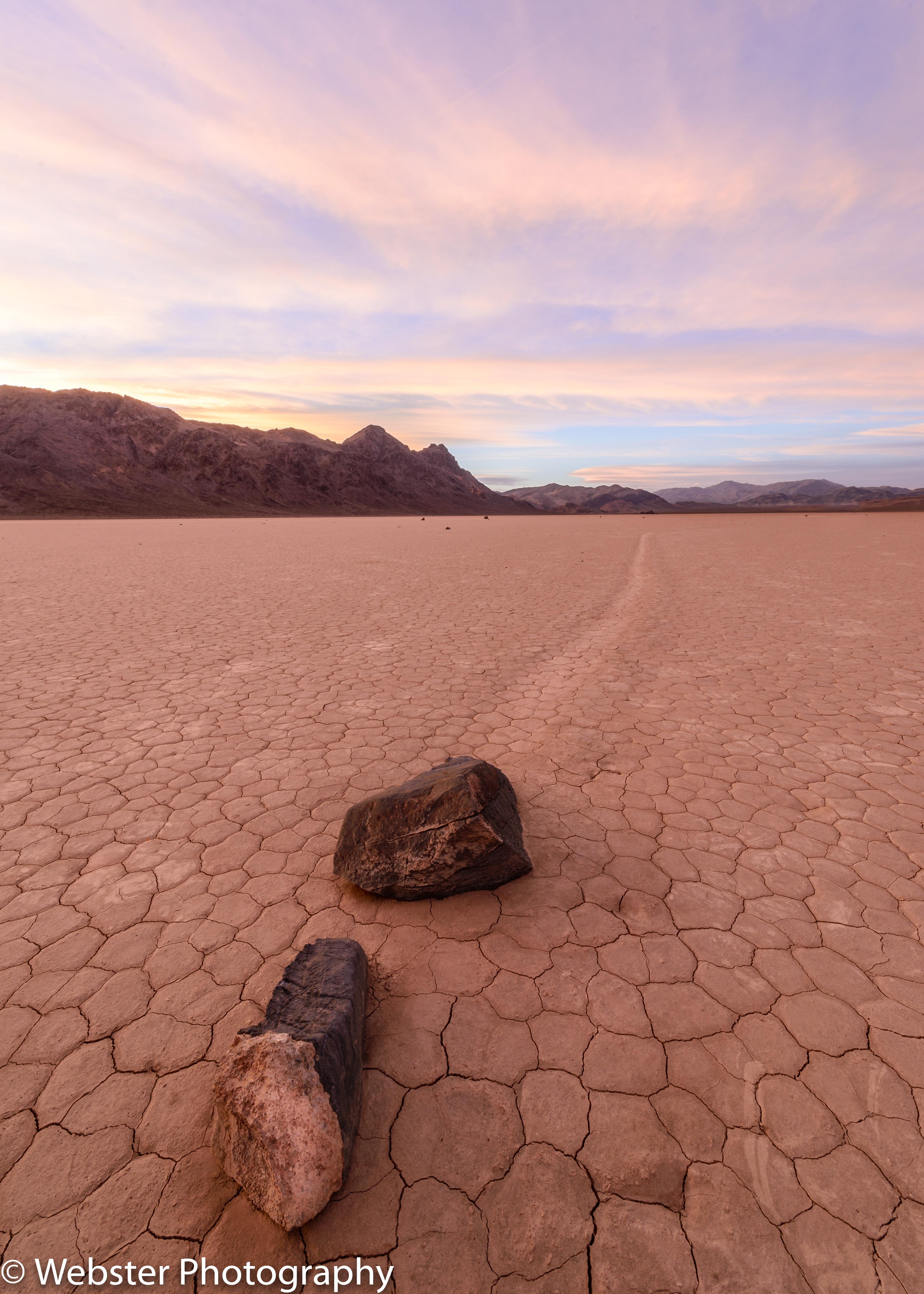
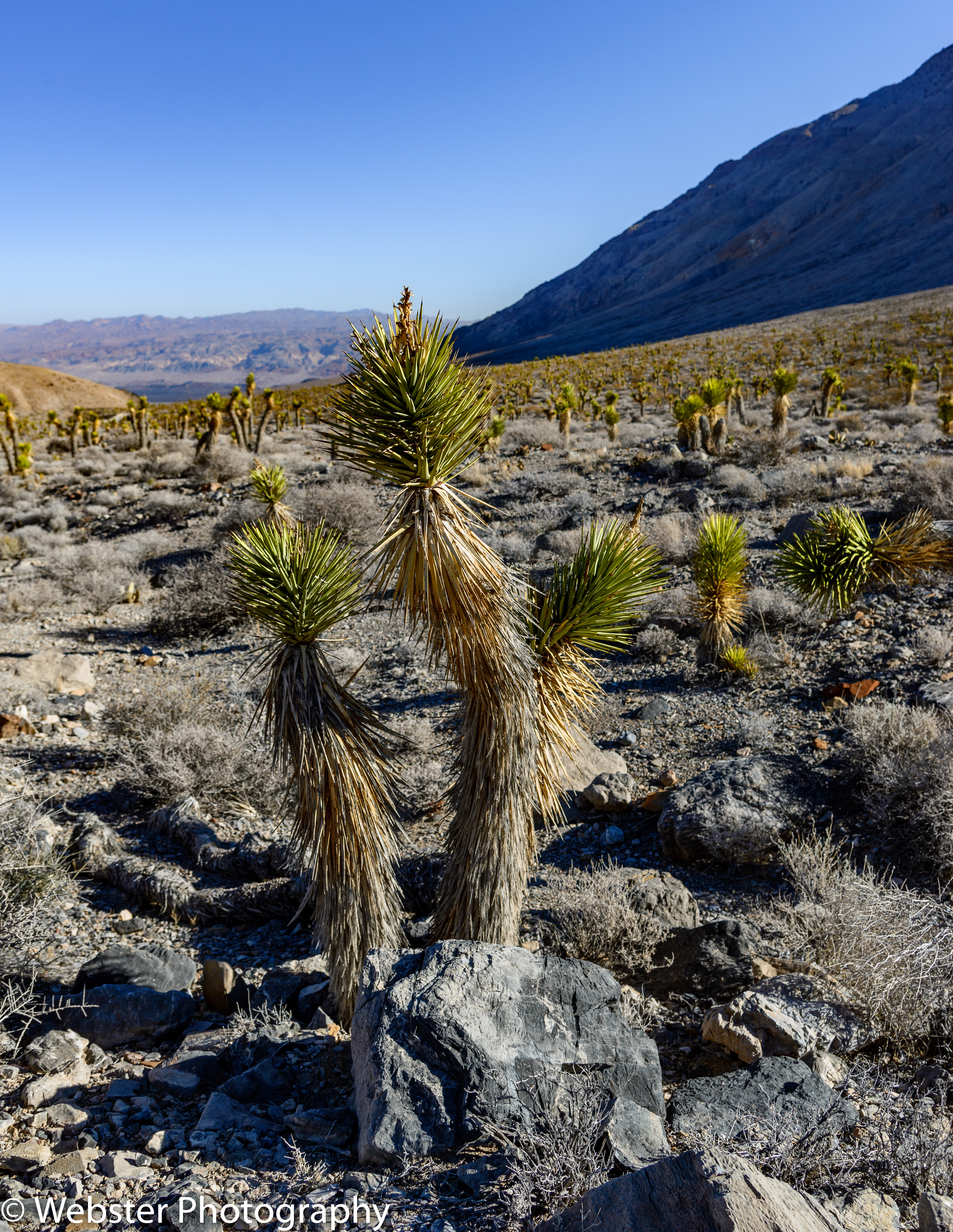
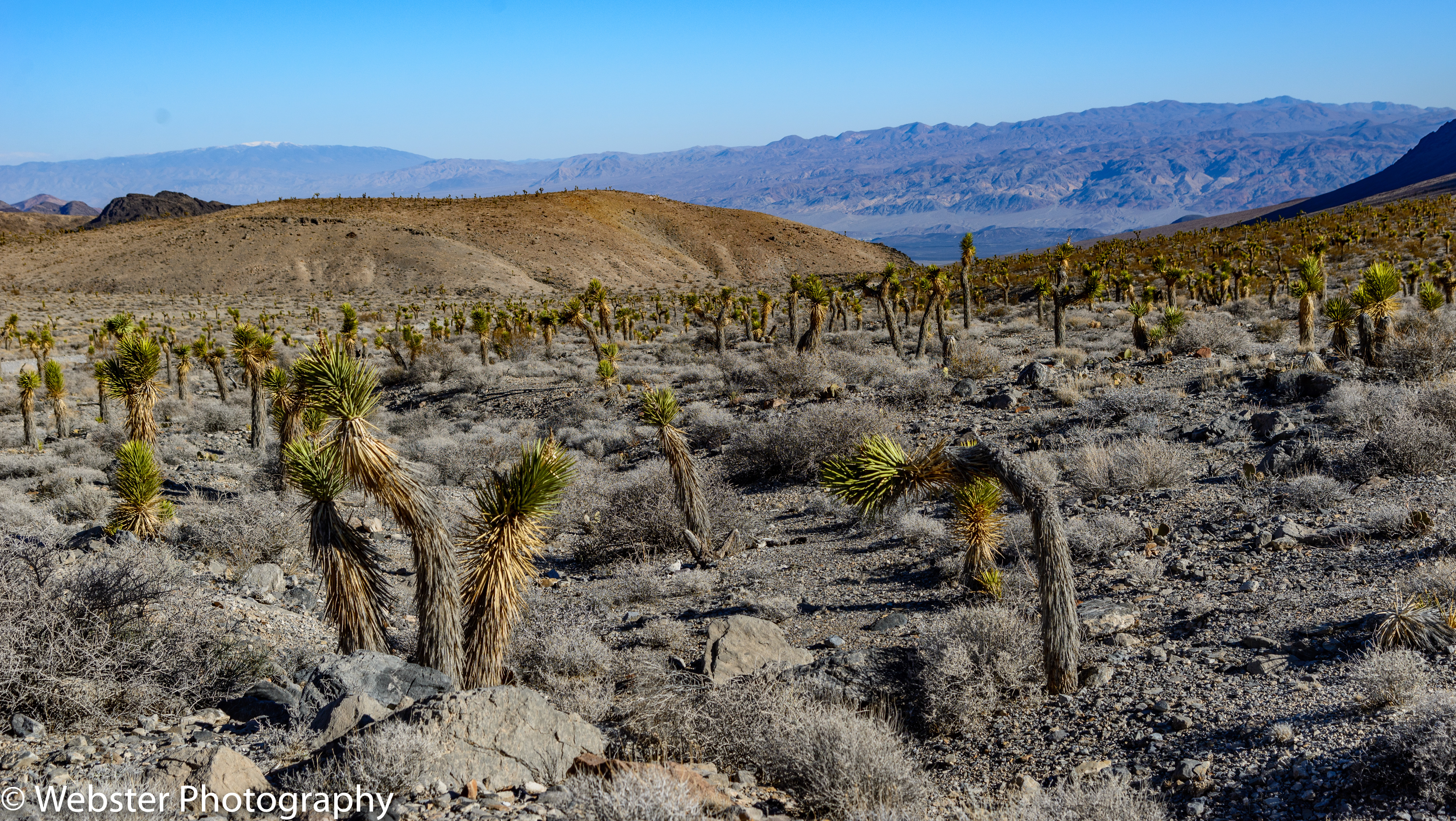
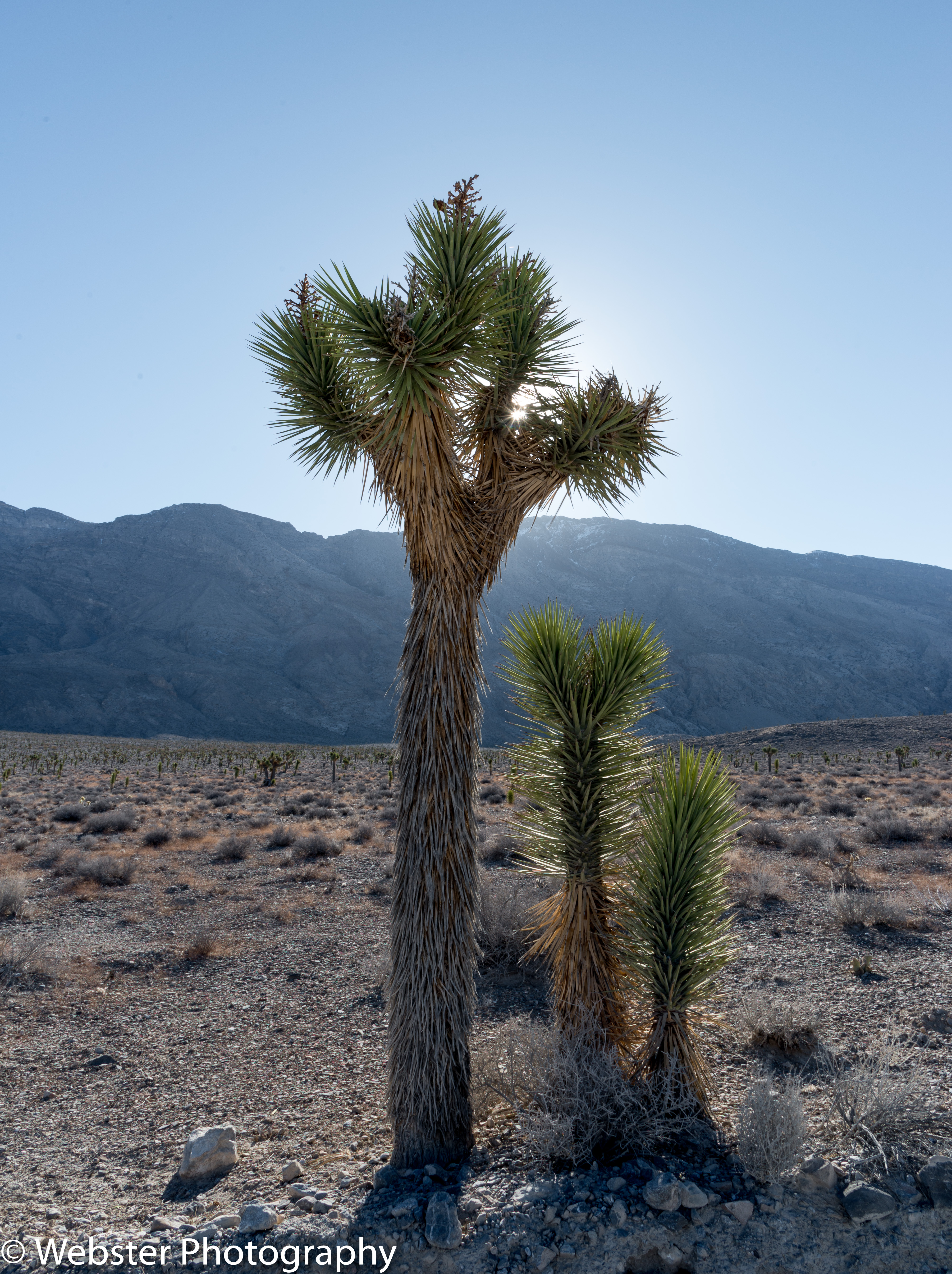
After spending a fitful night of sleep in the jeep, we ventured back out for sunrise photographs. We were not as lucky as with the sunset, but we weren’t too disappointed either. All in all, it was an amazing experience!! Oh, and by the way, even the gale-force winds did not move the rocks!!! (We weren’t expecting to see them move; few people have- it requires a unique combination of environmental factors for this to happen). On the way back, we stopped to photograph the Joshua Tree forests we saw along a particular section of Racetrack Road. Also, once back on the paved road and close to Furnace Creek, we stopped to photograph the windstorm.


After taking a shower, resting, and eating lunch, we ventured back out while we still had the 4×4. Originally, we were going to drive through Titus Canyon, but the road through the canyon was closed due to flood damage. Instead, we explored Echo Canyon where we found Inyo Mine, a gold mine originally established in 1906. We had the place to ourselves!!


On Day 5, we slept in, ate a good breakfast, and checked out of Furnace Creek. We were staying in Stovepipe Wells for the next 3 nights. We planned it this way so that we’d be closer to Mesquite Dunes for sunset and sunrise shoots. Lodging is also quite a bit cheaper at Stovepipe Wells. On the way to Stovepipe Wells, we stopped to explore Harmony Borax Works, one of the earliest successful borax mining operations in Death Valley, which was active from 1883 to 1888. This mill was famous not for its ore deposits, but for the Twenty Mule Team wagons used to transport the partially refined borax.


Further up the road, we stopped to hike the Salt Creek Interpretative Trail. We highlighted this hike because we wanted to see the rare Death Valley pupfish. This fish is only found in Death Valley due to its ability to withstand harsh conditions that would kill other fish: water that is 4 times more saline than the ocean, hot water up to 116 °F (47 °C), and cold water down to 32 °F (0 °C).They are thought to be the remainders of a large ecosystem of fish species that lived in Lake Manly, which dried up at the end of the last ice age leaving the present day Death Valley. We were extremely lucky to find tons of pupfish!! We were also delighted with the amazing landscape along the Salt Creek. It was a great surprise and topped our list of the hikes we did during our week in Death Valley.


After checking in at Stovepipe Wells, we set off for a sunset shoot at Mesquite Dunes. This was another iconic location that we had researched and put at the top of our list for photographing. There are other dune fields in the park, but Mesquite is the easiest to get to. Unfortunately, that means sharing it with lots of other people and it is much harder to find footprint-free expanses to photograph. We did 2 sunset shoots and 1 sunrise shoot during our stay. Overall, we were pleased with the shots we got. Like the sunset shots at the Racetrack, I love how the colors change throughout the stages of the sunset.


During the day on each of the next 2 days, we did day hikes; one each into Mosaic Canyon and Fall Canyon. Mosaic Canyon was very close to Stovepipe Wells lodge. We hiked all the way in, scrambling through several very narrow and difficult areas. I was amazed at all the patterns, textures, and colors of the rock walls.


We accessed Fall Canyon Trail from the Titus Canyon parking lot at the end of the 2-way road. The one-way road into Titus Canyon was closed due to flood damage. We hiked 3.25 miles to the dry falls and then returned. Like Mosaic Canyon, the patterns, textures, and colors were beautiful. Doing this hike made us feel a little better about not being able to drive into Titus Canyon.


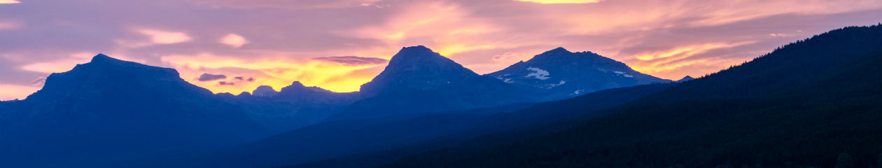
Our final sunset of our trip to Death Valley was spectacular!! We returned to Zabriskie’s Point; ending our trip where it began. I love how the light changes throughout a sunset. While it is wonderful to look at the sun setting in the west, sometimes the best view is behind you as we found that night.


Our final drive through the park was through Panamint Valley. The view of the valley was spectacular as we drove down the other side of the Panamint Mountain Range. Once in the valley, we encountered our first coyote of our visit. He was desperately seeking the only shade around, under the highway sign. We saw more water in the valley from the recent rains and saw snow on the peaks of the mountains in the distance. What a diverse environment!!


We sadly left Death Valley after spending a week there exploring canyons, wading through flooded salt flats, hiking down into a crater, braving 60 mph winds, sleeping overnight in a jeep, discovering pupfish and abandoned gold mines, hiking up and down immense sand dunes, and once again being awestruck by the expanse and diversity of our country. I tried to capture this as best I could with my camera, but nothing compares to being there!!