Haleakalā was originally part of Hawaii National Park along with the volcanoes of Mauna Loa and Kilauea on the island of Hawai’i, created in 1916. Hawai’i Volcanoes National Park was made into a separate national park in 1961. The name Haleakalā is Hawaiian for “house of the sun.” According to a local legend, the demigod Maui imprisoned the sun here in order to lengthen the day.
The park features the dormant Haleakala (East Maui) Volcano, which last erupted sometime between 1480 and 1600 AD. The park is divided into two distinct sections: the summit area and the coastal Kipahulu area. (Source: Wikipedia)
Established: August 1, 1916
Size: 33,264 Acres
Rank in Size: 52
# Visitors in 2018: 1,044,084


(Visited October 2019) My husband and I along with 2 of our good friends visited Haleakala on the way back from our trip to American Samoa. We visited both the Summit and Kipahulu areas, driving the Hana Highway in between. When we do research for our trips to the national parks, we read a lot of different sources and look at lots of photographs. As such, we imagine the ideal conditions even though we know that we are at the mercy of the conditions for the time we are there. And that is part of the challenge…. enjoy and capture the experience we have while there and embrace the beauty no matter the conditions. I guess you can probably tell, we didn’t hit Haleakala in the best of conditions; at least in the Summit area.
Summit Area
We drove up from Wailea early in morning so we could take a leisurely pace up to the Summit. Instead of trying to fight the crowds at the insanely early hour needed to see the sunrise, we decided to target sunset instead. Our first stop was the Park Headquarters Visitor Center where we got our passport stamps and hiking maps. We knew we would not make the summit before the Haleakala Visitor Center closed at noon. We then drove up the road to the Halemau’u Trailhead. We hiked about 3 miles roundtrip, just beyond the point where you can see into the crater (1.1 miles from TH). We hiked in and out of heavy cloud cover, but it was clear enough at times to get a good view into the crater. It was all very lush.


 along Halemau'u Trail_DSF1939-Edit")


After our hike, we continued up to the summit, experiencing heavier cloud cover. The Leleiwi Overlook was completely socked in. We got to the summit and walked around a bit and viewed the Haleakala Observatory, also known as the Haleakalā High Altitude Observatory Site. It is Hawaii’s first astronomical research observatory and is owned by the Institute for Astronomy of the University of Hawai’i, which operates some of the facilities on the site and leases portions to other organizations. Tenants include the Air Force Research Laboratory (AFRL) and the Las Cumbres Observatory Global Telescope Network (LCOGTN). At over 3,050 meters (10,010 ft) in altitude, the summit of Haleakala is above one third of the Earths’s troposphere and has excellent astronomical seeing conditions in the distance. (Source: Wikipedia).
We also staked out a place for viewing the sunset. We were still optimistic!! Afterall, weather patterns can change quickly!!


_IMG_0938")


While we waited for sunset, we hiked down Sliding Sands Trail. Unfortunately, we were completed socked in. We were hiking in the middle of clouds, getting soaked by the cold mist. We managed to hike 1 mile before turning around. We couldn’t see more than a few feet in front of us. So, we did the best we could to capture some of the beauty we saw in the details in the landscape….. the deep copper colors that occasionally interrupted the black lava gravel, the brilliant green vegetation that miraculously grew out of the barren landscape, the porous lava rocks, and the Silver Swords that gleamed in the moist atmosphere and against the stark contrast of the lava landscape. So, while we have an experience to look back on, we still wish we could have seen the immense crater with all the cinder cones and moonlike landscape. I guess we’ll have to go back!!


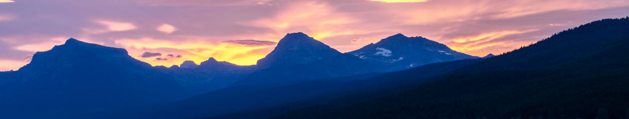
Back to our sunset spot and not feeling very optimistic! After awhile, we decided to start heading down the mountain, hoping to get below the bank of clouds and catching the sunset there. It turned out to be a good plan; although still not one of the best sunsets we’ve ever seen.


Kipahulu Area
We spent the entire next day driving the Hana Highway, stopping multiple times along the way. Our destination was Hana where we stayed for 2 nights. We enjoyed a relaxing evening with a good meal at Travaasa Hana and then drove the rest of the Hana Highway to the entrance of the park the next morning. This leg of the journey (about 11 miles) was even more harrowing than the first 40 or so miles. After stopping at the Kipahulu Visitor Center for passport stamps, hiking maps and snacks, we set off on the Pipiwai Trail; a 4 mile round trip hike up to Waimoku Falls. We saw other waterfalls along the way as well as the largest and most amazing bamboo forest I’ve seen. Waimoku Falls at the end of the trail was a wonderful reward. We were lucky for most of our hike, only getting caught in the rain near the end of our return trip.


After a short break to wait out the rain, we took another short hike on the Kuloa Trail to the Pools of Ohe’o and the coastline. What a spectacular site!! I had read a lot about the pools, warning people about the hazards of swimming in them. It was hard to imagine anyone swimming in these gushing waters; no one attempted it the day we were there! It must be much calmer at other times.


We are really glad we experienced both sides of Haleakala National Park; both reveal very different aspects of volcanic landscapes. Of course, we would love to return one day to explore even more of this amazing park.