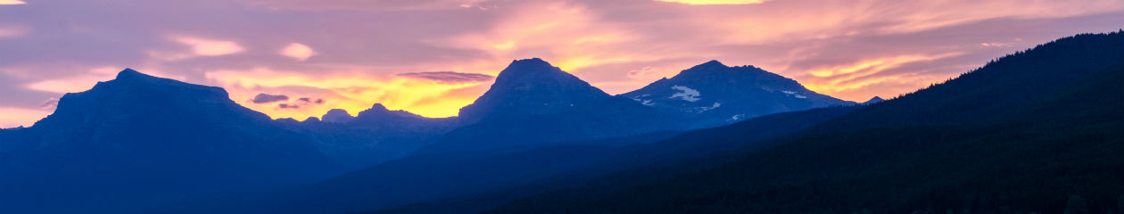
The Virgin Islands National Park is a U.S. National Park preserving about 60% of the land area of St. John as well as more than 5,500 acres of adjacent ocean, and nearly all of Hassel Island just off the Charlotte Amalie, St. Thomas harbor.
The park is well-known for scuba diving and snorkeling, and has miles of hiking trails through the tropical rainforest. This island park on St. John preserves Taino archaeological sites and the ruins of sugar plantations from Columbus’s time, as well as all the natural environs. Surrounding the pristine beaches are mangrove forests, seagrass beds, and coral reefs.
Two Category 5 hurricanes impacted the Virgin Islands in September 2017. The park received 112,287 visitors in 2018, after having received 304,408 visitors in 2017, and an average of more than 450,000 visitors per year in the preceding ten year period from 2007 to 2016. The park was reopened in December 2017 with all roads, trails and beaches declared accessible to visitors. (Source: Wikipedia and NPS website)
Established: August 2, 1956
Size: 15,052 acres
Rank: 59
#Visitors in 2018: 112,287
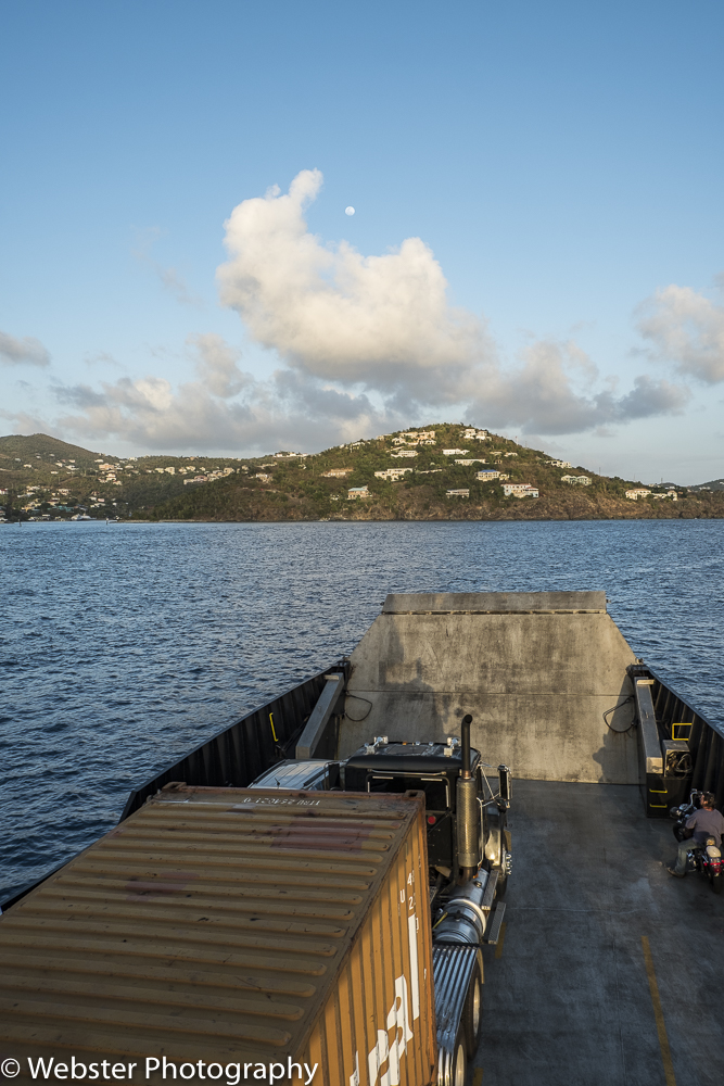
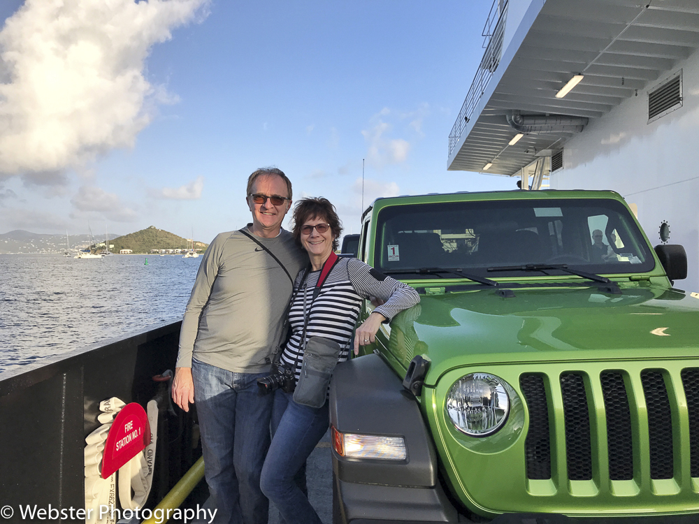
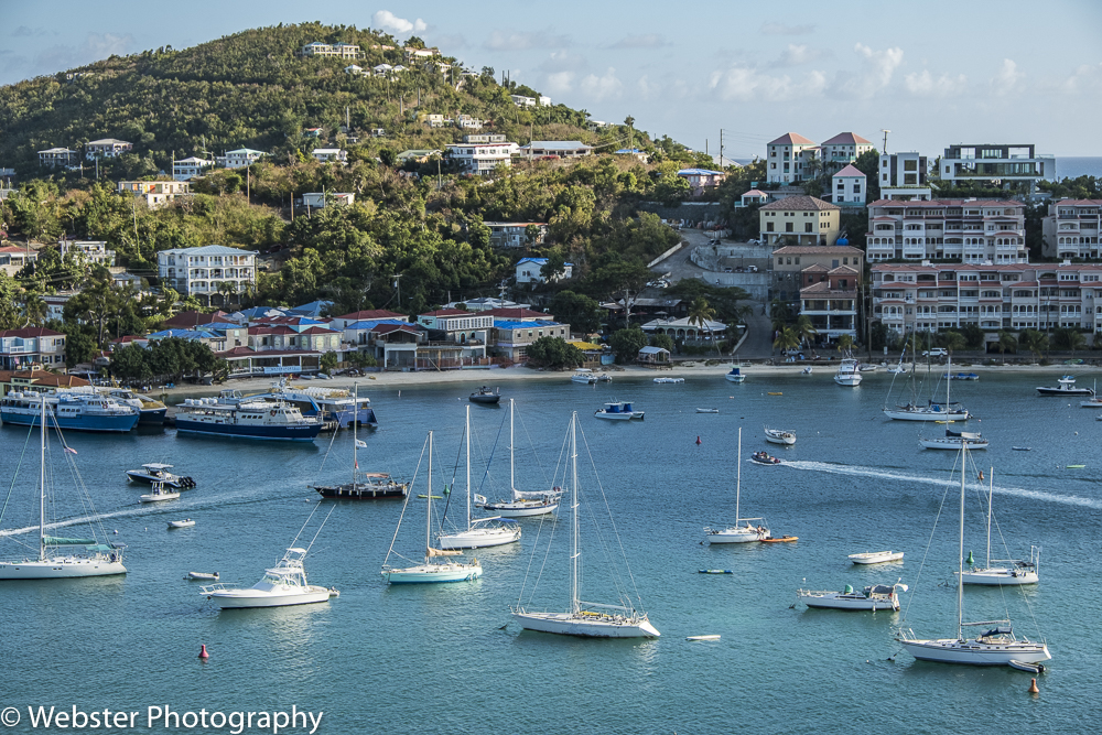
(February 2016 and February 2019). We visited St. John both times with our good friends and traveling buddies and their family. We stayed in a beautiful villa in Cruz Bay, using it as a base to explore many parts of the island. Getting to St. John is a bit of an adventure in itself. With no major airport on the island, we had to fly to St. Thomas and then take a car ferry over to St. John. We picked up a rental car in St. Thomas both times.
For this travel story, I’m going to tell the story by the places we visited, some of which we experienced in both 2016 and 2019. All the places are within the boundaries of the national park.
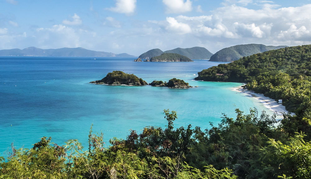
One of the most scenic and iconic places we visited both times was Trunk Bay. It is popular for a reason… it is absolutely gorgeous! My favorite photo of St. John is of Trunk Bay from a turn off on North Shore Road.
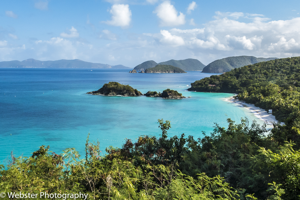
Once down on the beach, we enjoyed walking the beach, swimming, and snorkeling along the underwater trail and coastline of the small islands (Cays) just off shore. We rented snorkeling gear at the kiosk on the path leading to the beach. We went to Trunk Bay on our both our visits and would definitely go there again if we ever go back… truly a highlight! (Note: some of the photos were taken by Will Archer Photography https://www.willarcherphotography.com/)


Another highlight of both visits was hiking the Ram Head Trail on the southeastern tip of the island. There are beautiful views of beaches, islands, cacti and cliffs along this 2.3 mile out and back trail.


Another beach we visited both times, was Maho Bay. This is a very narrow beach but where we were able to snorkel with turtles and see lots of birds. Again, thank you Will Archer Photography for capturing some of these photos.


In 2016, we visited Annaberg Sugar Mill ruins along the north coast of the island.
The Windmill at Annaberg is the main focal point at the ruins and the largest windmill in the Virgin Islands. Built between 1810 and 1830, the windmill could produce between 300 and 500 gallons of juice within an hour. Slaves played an important role in the production of the sugar at Annaberg Sugar Plantation. Looking out from Annaberg, you can see Leinster Bay, the Sir Frances Drake Channel and a few of the British Virgin Islands. (Source: https://cimmaronstjohn.com/blog/annaberg-sugar-plantation/)


We hiked the Leinster Bay Trail, a 1.9 mile out and back trail from Annaberg Sugar Mill Ruins ending at Watermelon Bay where we relaxed on the beach for awhile.


One of the hikes we did on our second visit was the Lind Point Trail, not far from the National Park Visitor Center in Cruz Bay. The best view from this trail was at the top, looking down into Cruz Bay.
Another first was the Cinnamon Bay Loop Trail, a 0.5 mile shaded loop trail that shows you the island’s history of old sugar factories.


After our hike around the Cinnamon Bay Loop Trail, we hiked a nearby trail, the America Hill spur of Cinnamon Bay trail. At the end of the trail are the America Hill Great House ruins, once home to sugar cane plantations and bay rum distilleries, the most prosperous on island. The views of the north shore of St John are stunning.


While over in the Cinnamon Bay area, we drove down to Cinnamon Bay Beach. We saw a lot of hurricane damage during our 2019 visit. This beach was hit particularly hard.


Another hike we did for the first time was the Francis Bay Trail, located on the north side of the island. This was an easy walking trail through the salt marsh on a boardwalk and on the dirt trail surrounding the area. We saw some wildlife, Francis Beach and some plantation ruins. There certainly is no shortage of ruins on St. John!


On our way back from Francis Bay, we stopped to hike up to Peace Hill… more ruins and a beautiful view of Hawksnest Bay!


Another first was hiking the Brown Bay Trail. We hiked to the Bay and back. We had to do a bit of bushwhacking around the Bay and found more ruins (imagine that!) and saw lots of Brown Pelicans.


On the way to Brown Bay Trail, we stopped to walk around the Catherineberg Sugar Mill Ruins. The ruins are an example of another 18th-century sugar and rum factory.


The last memory I want to share and as a good way to end this story are the sunset cruises we took on both visits. We hired a sailboat out of Cruz Bay and sailed along the north shore of the islands.


I expect we will visit St. John again. I had traveled to several of the Caribbean islands in the 1980’s and 90’s and St. John is by far one of the most beautiful. The fact that over 60% of the island is protected by the U.S. National Park system makes it extra special!